Covington night lights from space
Night Light of Covington (Georgia) from space (United States) Src. Average luminocity for 10x10km area is 68.2857% and for 50x50km: 34.5292%.
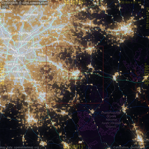
Analysis of Covington night lights 2016
Square area 10x10 km:
 10.81%
90-99
12.82%80-89
12.27%70-79
14.1%60-69
16.12%50-59
10.07%40-49
8.61%30-39
8.06%20-29
7.14%10-19
0%0-9
0%Square area 50x50 km:
2.16%90-99
2.57%80-89
4.63%70-79
8%60-69
9.6%50-59
7.24%40-49
6.92%30-39
7.51%20-29
8.13%10-19
10.22%0-9
33.03%Clear (daylight) street map image can be seen on geolist.org.
Map coordinates:
34° 10' 49.7" North, 84° 33' 47.9" West
33° 35' 48.4" North, 83° 51' 36.6" West
33° 0' 32.9" North, 83° 9' 25.4" West
Some cities around Covington sort by population:
• Stonecrest
28.3 km =17.6 mi,  296°
296°
• Redan
30.1 km =18.7 mi, 303°
• Stockbridge
35.1 km =21.8 mi,  260°
260°
• McDonough
31.3 km =19.4 mi,  237°
237°
• Snellville
32.5 km =20.2 mi,  332°
332°
• Conyers
16.6 km =10.3 mi, 298°
• Monroe
25.9 km =16.1 mi,  31°
31°
• Loganville
27.2 km =16.9 mi,  352°
352°
4189785 (p: 13,916)
Sources (retrieved 2019-11-25):
» Earth at Night: Flat Maps 2012, 2016