Country Club night lights from space
Night Light of Country Club (Florida) from space (United States) Src. Average luminocity for 10x10km area is 96.4286% and for 50x50km: 65.594%.
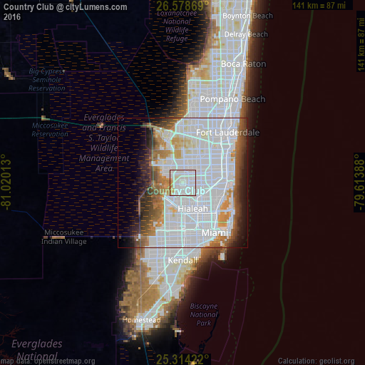
Analysis of Country Club night lights 2016
Square area 10x10 km:
 48.41%
90-99
39.29%80-89
4.76%70-79
7.54%60-69
0%50-59
0%40-49
0%30-39
0%20-29
0%10-19
0%0-9
0%Square area 50x50 km:
36.2%90-99
13.09%80-89
2.92%70-79
3.86%60-69
5.51%50-59
3.86%40-49
4.62%30-39
4.45%20-29
4.2%10-19
5.19%0-9
16.11%Clear (daylight) street map image can be seen on geolist.org.
Map coordinates:
26° 34' 43.3" North, 81° 1' 12.5" West
25° 56' 53.3" North, 80° 19' 1.2" West
25° 18' 51.2" North, 79° 36' 50" West
Some cities around Country Club sort by population:
• Miami Gardens
7.2 km =4.5 mi,  95°
95°
• Carol City
7.2 km =4.5 mi, 96°
• Miami Lakes
4.5 km =2.8 mi,  169°
169°
• Hialeah Gardens
9.3 km =5.8 mi,  184°
184°
• Opa-locka
8.4 km =5.2 mi,  127°
127°
• Scott Lake
8.5 km =5.3 mi,  94°
94°
• Lake Lucerne
7.8 km =4.8 mi,  75°
75°
• Palm Springs North
2.2 km =1.4 mi,  229°
229°
4152093 (p: 47,105)
Sources (retrieved 2019-11-25):
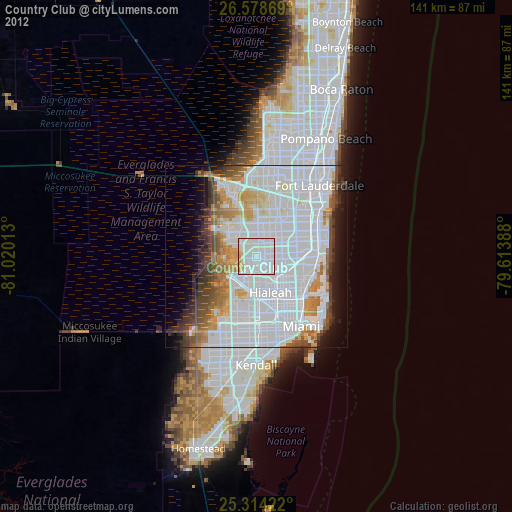
» Earth at Night: Flat Maps 2012, 2016