Coral Gables night lights from space
Night Light of Coral Gables (Florida) from space (United States) Src. Average luminocity for 10x10km area is 89.9148% and for 50x50km: 53.1147%.
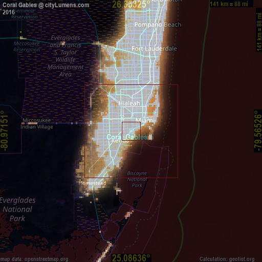

Analysis of Coral Gables night lights 2016
Square area 10x10 km:
 58.71%
90-99
19.13%80-89
3.41%70-79
1.33%60-69
4.17%50-59
5.11%40-49
5.3%30-39
2.27%20-29
0.57%10-19
0%0-9
0%Square area 50x50 km:
26.33%90-99
9.45%80-89
2.4%70-79
3.43%60-69
8.4%50-59
4.67%40-49
4.11%30-39
3.44%20-29
3.81%10-19
5.15%0-9
28.8%Clear (daylight) street map image can be seen on geolist.org.
Map coordinates:
26° 21' 11.7" North, 80° 58' 17.4" West
25° 43' 17.4" North, 80° 16' 6.2" West
25° 5' 10.9" North, 79° 33' 54.9" West
Some cities around Coral Gables sort by population:
• Kendall
6.8 km =4.2 mi,  226°
226°
• Flagami
6.6 km =4.1 mi,  313°
313°
• Westchester
7 km =4.3 mi,  302°
302°
• Coconut Grove
1.5 km =0.9 mi,  130°
130°
• Pinecrest
7.2 km =4.5 mi,  213°
213°
• Glenvar Heights
5.9 km =3.7 mi,  254°
254°
• South Miami
2.9 km =1.8 mi,  238°
238°
• West Miami
5.4 km =3.4 mi,  329°
329°
4151871 (p: 51,117)
Sources (retrieved 2019-11-25):
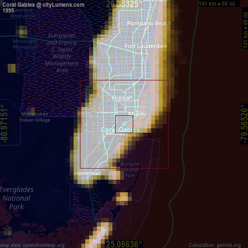
» NASA, Earths city lights 1995
» NASA city lights 2003
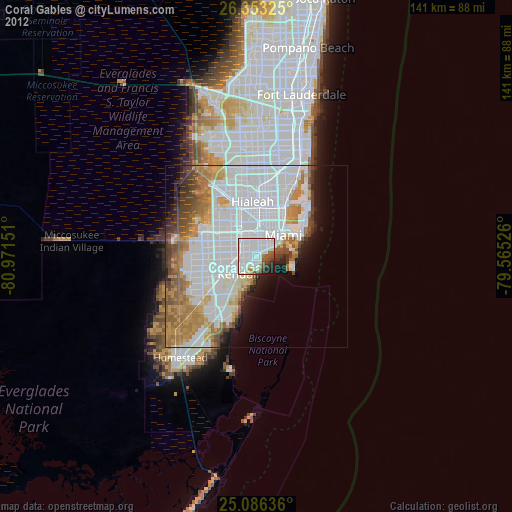
» Earth at Night: Flat Maps 2012, 2016