Columbia night lights from space
Night Light of Columbia (Illinois) from space (United States) Src. Average luminocity for 10x10km area is 34.789% and for 50x50km: 45.9734%.
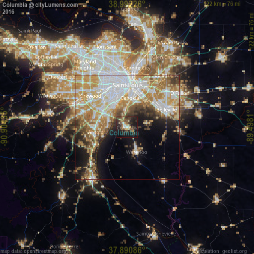
Analysis of Columbia night lights 2016
Square area 10x10 km:
 1.62%
1.62%90-99
4.71%80-89
4.87%70-79
2.6%60-69
4.22%50-59
5.03%40-49
7.95%30-39
13.64%20-29
15.1%10-19
33.93%0-9
6.33%Square area 50x50 km:
12.04%90-99
9.53%80-89
6.41%70-79
8.19%60-69
6.63%50-59
5.04%40-49
3.64%30-39
4.09%20-29
4.73%10-19
9.29%0-9
30.41%Clear (daylight) street map image can be seen on geolist.org.
Map coordinates:
38° 59' 32.1" North, 90° 54' 15.7" West
38° 26' 37.2" North, 90° 12' 4.4" West
37° 53' 27.1" North, 89° 29' 53.2" West
Some cities around Columbia sort by population:
• Oakville
9.5 km =5.9 mi,  288°
288°
• Mehlville
12.8 km =8 mi,  304°
304°
• Arnold
15.4 km =9.6 mi,  265°
265°
• Affton
16.5 km =10.3 mi,  316°
316°
• Lemay
12.1 km =7.5 mi,  325°
325°
• Concord
16.3 km =10.1 mi, 303°
• Cahokia
14.2 km =8.8 mi,  3°
3°
• Waterloo
12.8 km =8 mi,  159°
159°
4236206 (p: 10,191)
Sources (retrieved 2019-11-25):
» Earth at Night: Flat Maps 2012, 2016