Clarksburg night lights from space
Night Light of Clarksburg (West Virginia) from space (United States) Src. Average luminocity for 10x10km area is 45.716% and for 50x50km: 8.5192%.
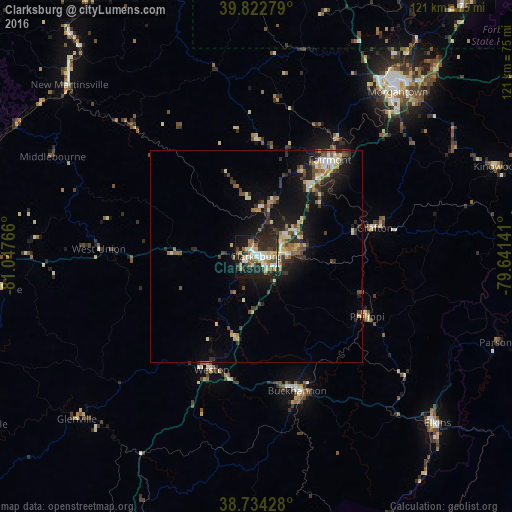
Analysis of Clarksburg night lights 2016
Square area 10x10 km:
 7.65%
7.65%90-99
9.52%80-89
5.27%70-79
5.44%60-69
7.31%50-59
4.25%40-49
4.08%30-39
5.95%20-29
25.68%10-19
21.43%0-9
3.4%Square area 50x50 km:
0.81%90-99
1.35%80-89
0.91%70-79
1.02%60-69
1%50-59
1.08%40-49
1.24%30-39
1.8%20-29
2.72%10-19
6.9%0-9
81.16%Clear (daylight) street map image can be seen on geolist.org.
Map coordinates:
39° 49' 22" North, 81° 2' 51.6" West
39° 16' 50.3" North, 80° 20' 40.3" West
38° 44' 3.4" North, 79° 38' 29.1" West
Some cities around Clarksburg sort by population:
• Morgantown
51.2 km =31.8 mi,  40°
40°
• Fairmont
28.6 km =17.8 mi, 37°
• Bridgeport
7.6 km =4.7 mi,  85°
85°
• Elkins
58.3 km =36.2 mi,  132°
132°
• Buckhannon
33.3 km =20.7 mi,  163°
163°
• New Martinsville
59.8 km =37.2 mi,  312°
312°
• Brookhaven
52.8 km =32.8 mi,  45°
45°
• Grafton
28.8 km =17.9 mi,  76°
76°
4802316 (p: 16,152)
Sources (retrieved 2019-11-25):
» Earth at Night: Flat Maps 2012, 2016