Chickasha night lights from space
Night Light of Chickasha (Oklahoma) from space (United States) Src. Average luminocity for 10x10km area is 40.5524% and for 50x50km: 5.4987%.
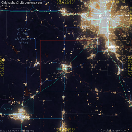
Analysis of Chickasha night lights 2016
Square area 10x10 km:
 3.5%
3.5%90-99
6.29%80-89
9.97%70-79
7.17%60-69
4.55%50-59
4.37%40-49
6.12%30-39
4.02%20-29
9.44%10-19
34.62%0-9
9.97%Square area 50x50 km:
0.14%90-99
0.25%80-89
0.83%70-79
0.76%60-69
0.8%50-59
0.89%40-49
1.39%30-39
1.56%20-29
1.77%10-19
4.64%0-9
86.97%Clear (daylight) street map image can be seen on geolist.org.
Map coordinates:
35° 37' 34.1" North, 98° 38' 22.4" West
35° 3' 9.3" North, 97° 56' 11.1" West
34° 28' 29.8" North, 97° 13' 59.9" West
Some cities around Chickasha sort by population:
• Norman
49 km =30.4 mi,  67°
67°
• Moore
51.8 km =32.2 mi,  52°
52°
• Mustang
41.6 km =25.8 mi,  27°
27°
• Newcastle
37.5 km =23.3 mi, 54°
• Blanchard
27 km =16.8 mi, 69°
• Tuttle
28.8 km =17.9 mi,  23°
23°
• Anadarko
28 km =17.4 mi,  274°
274°
• Noble
50.2 km =31.2 mi,  78°
78°
4533029 (p: 16,488)
Sources (retrieved 2019-11-25):
» Earth at Night: Flat Maps 2012, 2016