Carrollton night lights from space
Night Light of Carrollton (Michigan) from space (United States) Src. Average luminocity for 10x10km area is 69.9508% and for 50x50km: 15.6517%.
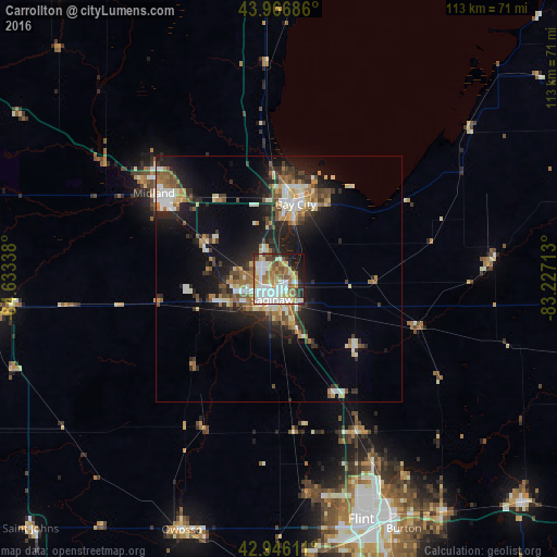
Analysis of Carrollton night lights 2016
Square area 10x10 km:
 19.21%
90-99
18.1%80-89
9.52%70-79
9.05%60-69
11.59%50-59
8.89%40-49
4.44%30-39
3.49%20-29
8.41%10-19
6.67%0-9
0.63%Square area 50x50 km:
2.14%90-99
2.77%80-89
1.83%70-79
1.86%60-69
2.34%50-59
2.16%40-49
1.86%30-39
2.15%20-29
4.79%10-19
10.03%0-9
68.07%Clear (daylight) street map image can be seen on geolist.org.
Map coordinates:
43° 58' 0.7" North, 84° 38' 0.2" West
43° 27' 31.1" North, 83° 55' 48.9" West
42° 56' 46" North, 83° 13' 37.7" West
Some cities around Carrollton sort by population:
• Saginaw
4.7 km =2.9 mi,  200°
200°
• Bay City
15.5 km =9.6 mi,  12°
12°
• Saginaw Township North
6.2 km =3.9 mi,  271°
271°
• Freeland
17.2 km =10.7 mi,  295°
295°
• Bridgeport
11.7 km =7.3 mi,  160°
160°
• Buena Vista
5 km =3.1 mi,  149°
149°
• Shields
11.3 km =7 mi,  244°
244°
• Frankenmuth
21 km =13 mi,  132°
132°
4988132 (p: 6,583)
Sources (retrieved 2019-11-25):
» Earth at Night: Flat Maps 2012, 2016