Boiling Springs night lights from space
Night Light of Boiling Springs (South Carolina) from space (United States) Src. Average luminocity for 10x10km area is 0.0733% and for 50x50km: 4.8659%.
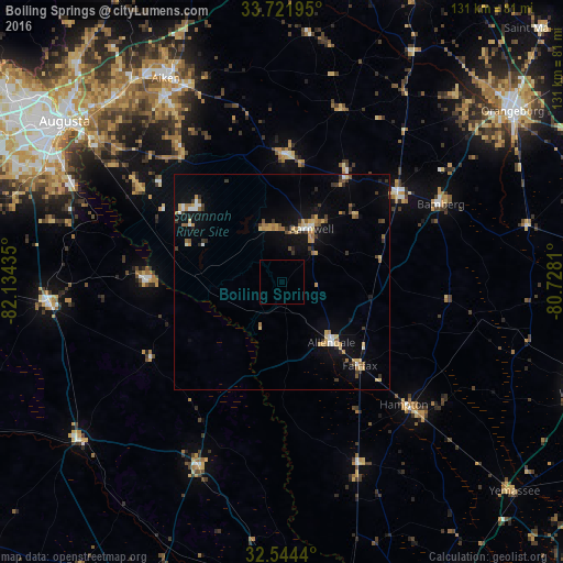
Analysis of Boiling Springs night lights 2016
Square area 10x10 km:
 0%
0%90-99
0%80-89
0%70-79
0%60-69
0%50-59
0%40-49
0%30-39
0%20-29
0%10-19
0%0-9
100%Square area 50x50 km:
0.37%90-99
0.4%80-89
0.77%70-79
0.82%60-69
0.64%50-59
0.54%40-49
0.42%30-39
0.97%20-29
0.5%10-19
3.22%0-9
91.35%Clear (daylight) street map image can be seen on geolist.org.
Map coordinates:
33° 43' 19" North, 82° 8' 3.7" West
33° 8' 6.5" North, 81° 25' 52.4" West
32° 32' 39.8" North, 80° 43' 41.2" West
Some cities around Boiling Springs sort by population:
• Augusta
62.8 km =39 mi,  306°
306°
• Martinez
73.4 km =45.6 mi, 305°
• Aiken
54.3 km =33.7 mi,  330°
330°
• North Augusta
64.2 km =39.9 mi, 309°
• Orangeburg
66.6 km =41.4 mi,  53°
53°
• Belvedere
64.9 km =40.3 mi, 312°
• Waynesboro
54.7 km =34 mi,  264°
264°
• Walterboro
75.7 km =47 mi,  109°
109°
4571804 (p: 5,076)
Sources (retrieved 2019-11-25):
» Earth at Night: Flat Maps 2012, 2016