Ballenger Creek night lights from space
Night Light of Ballenger Creek (Maryland) from space (United States) Src. Average luminocity for 10x10km area is 51.4099% and for 50x50km: 17.7946%.
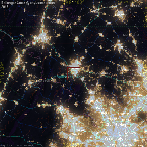
Analysis of Ballenger Creek night lights 2016
Square area 10x10 km:
 15.14%
90-99
10.54%80-89
3.74%70-79
6.46%60-69
4.25%50-59
4.59%40-49
6.63%30-39
6.46%20-29
18.88%10-19
19.9%0-9
3.4%Square area 50x50 km:
2.8%90-99
2.4%80-89
1.84%70-79
2.13%60-69
2.3%50-59
2.73%40-49
2.6%30-39
3.48%20-29
5.07%10-19
12.31%0-9
62.34%Clear (daylight) street map image can be seen on geolist.org.
Map coordinates:
39° 54' 50.5" North, 78° 8' 18.2" West
39° 22' 21.4" North, 77° 26' 6.9" West
38° 49' 37" North, 76° 43' 55.7" West
Some cities around Ballenger Creek sort by population:
• Frederick
5.1 km =3.2 mi,  24°
24°
• Clarksburg
20 km =12.4 mi,  137°
137°
• Green Valley
13.8 km =8.6 mi,  120°
120°
• Urbana
8.9 km =5.5 mi,  125°
125°
• Linganore
20.9 km =13 mi,  68°
68°
• Brunswick
17.8 km =11.1 mi,  248°
248°
• Walkersville
14.5 km =9 mi,  29°
29°
• Spring Ridge
7.8 km =4.8 mi, 65°
4347839 (p: 18,274)
Sources (retrieved 2019-11-25):
» Earth at Night: Flat Maps 2012, 2016