Zolochiv night lights from space
Night Light of Zolochiv (Lviv) from space (Ukraine) Src. Average luminocity for 10x10km area is 0.3222% and for 50x50km: 0.0801%.
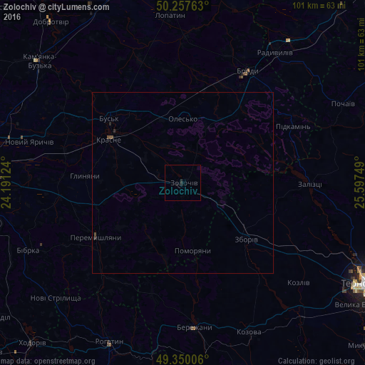
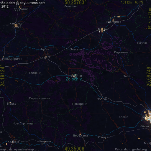
Analysis of Zolochiv night lights 2016
Square area 10x10 km:
 0%
0%90-99
0%80-89
0%70-79
0%60-69
0%50-59
0%40-49
0%30-39
0%20-29
1.07%10-19
0.53%0-9
98.4%Square area 50x50 km:
0%90-99
0%80-89
0%70-79
0%60-69
0%50-59
0.02%40-49
0.07%30-39
0.02%20-29
0.09%10-19
0.02%0-9
99.78%Clear (daylight) street map image can be seen on geolist.org.
Map coordinates:
50° 15' 27.5" North, 24° 11' 28.5" East
49° 48' 21.5" North, 24° 53' 39.7" East
49° 21' 0.2" North, 25° 35' 51" East
Some cities around Zolochiv sort by population:
• Brody
36.3 km =22.6 mi,  30°
30°
• Бережани
39.7 km =24.7 mi,  175°
175°
• Radyvyliv
44.3 km =27.5 mi,  35°
35°
• Kozova
45.2 km =28.1 mi,  155°
155°
• Rohatyn
48.7 km =30.3 mi,  204°
204°
• Peremyshlyany
28.8 km =17.9 mi,  237°
237°
• Zboriv
23.7 km =14.7 mi,  131°
131°
• Krasne
23.5 km =14.6 mi,  300°
300°
686896 (p: 22,608)
Sources (retrieved 2019-11-25):
» Earth at Night: Flat Maps 2012, 2016