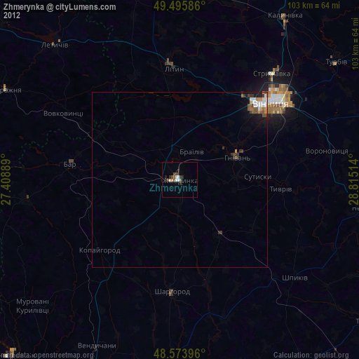
Zhmerynka night lights from space
Night Light of Zhmerynka (Vinnyts'ka) from space (Ukraine) Src. Average luminocity for 10x10km area is 3.8512% and for 50x50km: 1.1849%.
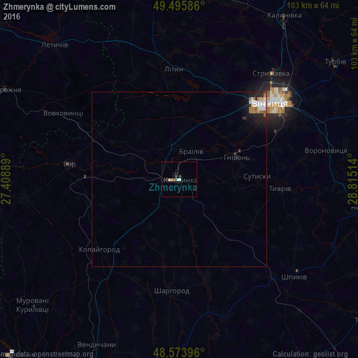
Analysis of Zhmerynka night lights 2016
Square area 10x10 km:
 0.15%
0.15%90-99
1.04%80-89
0.6%70-79
0%60-69
0.6%50-59
0.6%40-49
0.6%30-39
1.79%20-29
0%10-19
0.6%0-9
94.05%Square area 50x50 km:
0.22%90-99
0.27%80-89
0.06%70-79
0.1%60-69
0.21%50-59
0.15%40-49
0.06%30-39
0.14%20-29
0.36%10-19
0.75%0-9
97.67%Clear (daylight) street map image can be seen on geolist.org.
Map coordinates:
49° 29' 45.1" North, 27° 24' 32" East
49° 2' 13.4" North, 28° 6' 43.2" East
48° 34' 26.3" North, 28° 48' 54.5" East
Some cities around Zhmerynka sort by population:
• Vinnytsia
34.6 km =21.5 mi,  50°
50°
• Bar
31.6 km =19.6 mi,  278°
278°
• Nemyriv
53.4 km =33.2 mi,  97°
97°
• Letychiv
52 km =32.3 mi,  317°
317°
• Sharhorod
31.4 km =19.5 mi,  184°
184°
• Lityn
32.1 km =19.9 mi,  355°
355°
• Voronovytsya
42.2 km =26.2 mi,  78°
78°
• Sutysky
22.3 km =13.9 mi,  88°
88°
687116 (p: 35,960)
Sources (retrieved 2019-11-25):
» Earth at Night: Flat Maps 2012, 2016