Sutysky night lights from space
Night Light of Sutysky (Vinnyts'ka) from space (Ukraine) Src. Average luminocity for 10x10km area is 0.0045% and for 50x50km: 2.8787%.
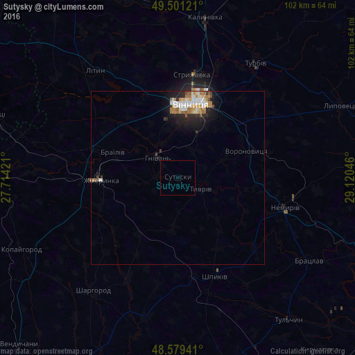
Analysis of Sutysky night lights 2016
Square area 10x10 km:
 0%
0%90-99
0%80-89
0%70-79
0%60-69
0%50-59
0%40-49
0%30-39
0%20-29
0%10-19
0%0-9
100%Square area 50x50 km:
0.51%90-99
0.59%80-89
0.25%70-79
0.37%60-69
0.65%50-59
0.3%40-49
0.18%30-39
0.18%20-29
0.79%10-19
1.7%0-9
94.49%Clear (daylight) street map image can be seen on geolist.org.
Map coordinates:
49° 30' 4.4" North, 27° 42' 51.2" East
49° 2' 32.8" North, 28° 25' 2.4" East
48° 34' 45.9" North, 29° 7' 13.7" East
Some cities around Sutysky sort by population:
• Vinnytsia
21.7 km =13.5 mi,  12°
12°
• Zhmerynka
22.3 km =13.9 mi,  268°
268°
• Nemyriv
31.7 km =19.7 mi,  104°
104°
• Sharhorod
40.5 km =25.2 mi,  218°
218°
• Lityn
39.8 km =24.7 mi,  322°
322°
• Turbiv
40.5 km =25.2 mi,  33°
33°
• Voronovytsya
20.6 km =12.8 mi,  68°
68°
• Bratslav
45.4 km =28.2 mi,  122°
122°
692146 (p: 6,111)
Sources (retrieved 2019-11-25):
» Earth at Night: Flat Maps 2012, 2016