Vinnytsia night lights from space
Night Light of Vinnytsia (Vinnyts'ka) from space (Ukraine) Src. Average luminocity for 10x10km area is 56.0414% and for 50x50km: 3.2714%.
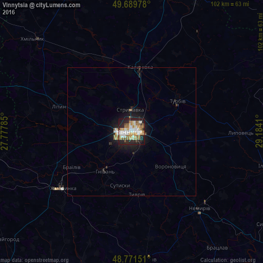
Analysis of Vinnytsia night lights 2016
Square area 10x10 km:
 10.96%
90-99
12.97%80-89
5.88%70-79
7.75%60-69
13.24%50-59
6.15%40-49
3.48%30-39
1.74%20-29
23.4%10-19
14.17%0-9
0.27%Square area 50x50 km:
0.51%90-99
0.6%80-89
0.25%70-79
0.36%60-69
0.71%50-59
0.3%40-49
0.23%30-39
0.21%20-29
1.23%10-19
2.68%0-9
92.92%Clear (daylight) street map image can be seen on geolist.org.
Map coordinates:
49° 41' 23.2" North, 27° 46' 40.3" East
49° 13' 58" North, 28° 28' 51.5" East
48° 46' 17.4" North, 29° 11' 2.8" East
Some cities around Vinnytsia sort by population:
• Zhmerynka
34.6 km =21.5 mi,  230°
230°
• Khmilnyk
52.5 km =32.6 mi,  313°
313°
• Kalynivka
24.8 km =15.4 mi,  7°
7°
• Nemyriv
39 km =24.2 mi,  138°
138°
• Lityn
30.8 km =19.1 mi,  289°
289°
• Turbiv
21.6 km =13.4 mi,  53°
53°
• Voronovytsya
20 km =12.4 mi,  133°
133°
• Sutysky
21.7 km =13.5 mi,  192°
192°
689558 (p: 352,115)
Sources (retrieved 2019-11-25):
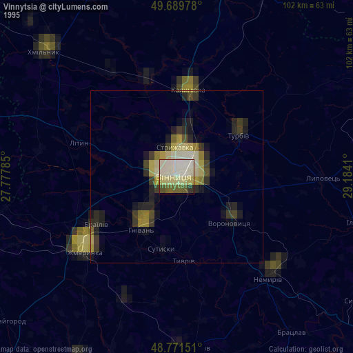
» NASA, Earths city lights 1995
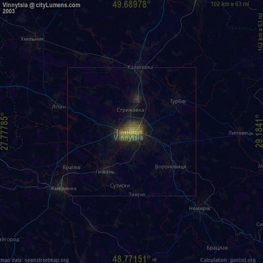
» NASA city lights 2003
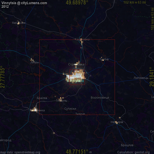
» Earth at Night: Flat Maps 2012, 2016