Khmilnyk night lights from space
Night Light of Khmilnyk (Vinnyts'ka) from space (Ukraine) Src. Average luminocity for 10x10km area is 0.3277% and for 50x50km: 0.0132%.
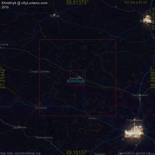
Analysis of Khmilnyk night lights 2016
Square area 10x10 km:
 0%
0%90-99
0%80-89
0%70-79
0%60-69
0%50-59
0%40-49
0%30-39
0.28%20-29
0.84%10-19
0%0-9
98.88%Square area 50x50 km:
0%90-99
0%80-89
0%70-79
0%60-69
0%50-59
0%40-49
0%30-39
0.01%20-29
0.03%10-19
0%0-9
99.95%Clear (daylight) street map image can be seen on geolist.org.
Map coordinates:
50° 0' 49.5" North, 27° 15' 15.9" East
49° 33' 35.2" North, 27° 57' 27.1" East
49° 6' 5.7" North, 28° 39' 38.4" East
Some cities around Khmilnyk sort by population:
• Vinnytsia
52.5 km =32.6 mi,  133°
133°
• Kalynivka
42.7 km =26.5 mi,  106°
106°
• Bar
57.2 km =35.5 mi,  200°
200°
• Letychiv
30.8 km =19.1 mi,  230°
230°
• Derazhnya
49.8 km =30.9 mi, 229°
• Lityn
27.6 km =17.1 mi,  161°
161°
• Chudniv
55.9 km =34.7 mi,  11°
11°
• Stara Syniava
24.9 km =15.5 mi,  281°
281°
706380 (p: 28,136)
Sources (retrieved 2019-11-25):
» Earth at Night: Flat Maps 2012, 2016