Antratsyt night lights from space
Night Light of Antratsyt (Luhansk) from space (Ukraine) Src. Average luminocity for 10x10km area is 8.3914% and for 50x50km: 0.9963%.
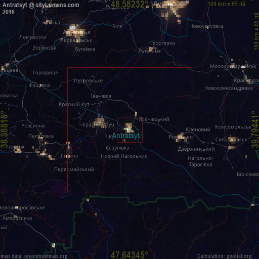
Analysis of Antratsyt night lights 2016
Square area 10x10 km:
 0%
0%90-99
0.6%80-89
0.89%70-79
1.49%60-69
2.38%50-59
0.74%40-49
2.83%30-39
1.19%20-29
1.64%10-19
1.93%0-9
86.31%Square area 50x50 km:
0%90-99
0.02%80-89
0.06%70-79
0.12%60-69
0.23%50-59
0.24%40-49
0.39%30-39
0.28%20-29
0.32%10-19
0.35%0-9
98%Clear (daylight) street map image can be seen on geolist.org.
Map coordinates:
48° 34' 56.4" North, 38° 23' 17.4" East
48° 6' 54.1" North, 39° 5' 28.6" East
47° 38' 36.4" North, 39° 47' 39.9" East
Some cities around Antratsyt sort by population:
• Krasnyy Luch
11.8 km =7.3 mi,  283°
283°
• Snizhne
25.7 km =16 mi,  247°
247°
• Roven’ky
21.6 km =13.4 mi,  99°
99°
• Lutuhyne
33.8 km =21 mi,  17°
17°
• Uspenka
31.1 km =19.3 mi,  9°
9°
• Kripens’kyy
4.9 km =3 mi,  210°
210°
• Miusyns’k
14.5 km =9 mi, 253°
• Kuybyshevo, RU
36.3 km =22.6 mi,  202°
202°
713259 (p: 61,600)
Sources (retrieved 2019-11-25):
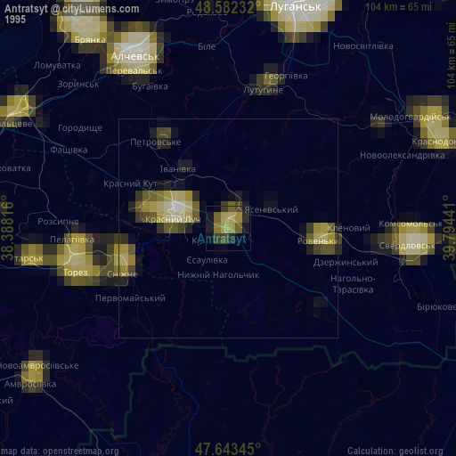
» NASA, Earths city lights 1995
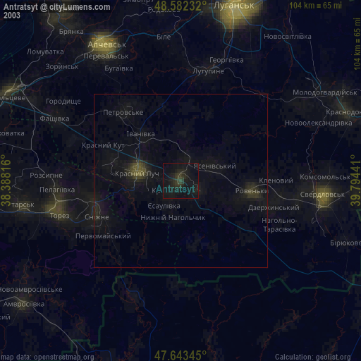
» NASA city lights 2003
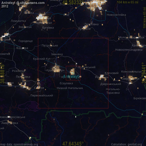
» Earth at Night: Flat Maps 2012, 2016