Sniatyn night lights from space
Night Light of Sniatyn (Ivano-Frankivsk) from space (Ukraine) Src. Average luminocity for 10x10km area is 0.2131% and for 50x50km: 0.3748%.
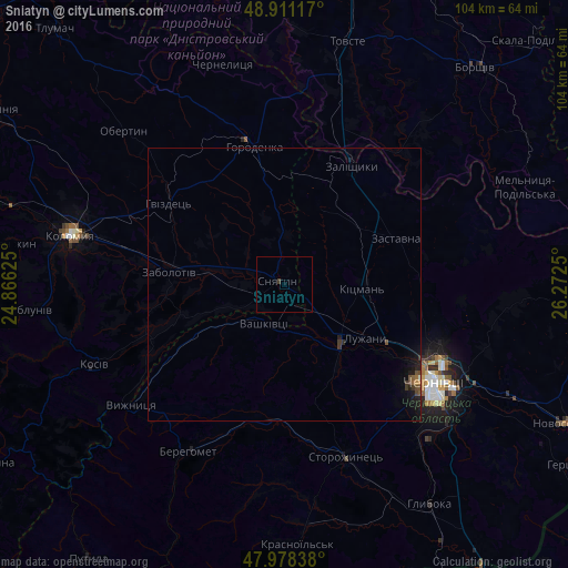
Analysis of Sniatyn night lights 2016
Square area 10x10 km:
 0%
0%90-99
0%80-89
0%70-79
0%60-69
0%50-59
0%40-49
0%30-39
0.57%20-29
0%10-19
0%0-9
99.43%Square area 50x50 km:
0%90-99
0.01%80-89
0%70-79
0.02%60-69
0.04%50-59
0.06%40-49
0.15%30-39
0.15%20-29
0.12%10-19
0.54%0-9
98.9%Clear (daylight) street map image can be seen on geolist.org.
Map coordinates:
48° 54' 40.2" North, 24° 51' 58.5" East
48° 26' 48.9" North, 25° 34' 9.7" East
47° 58' 42.2" North, 26° 16' 21" East
Some cities around Sniatyn sort by population:
• Chernivtsi
32.4 km =20.1 mi,  122°
122°
• Zalishchyky
25.1 km =15.6 mi,  29°
29°
• Horodenka
25.6 km =15.9 mi,  348°
348°
• Zastavna
21.9 km =13.6 mi,  67°
67°
• Berehomet
34 km =21.1 mi,  208°
208°
• Vashkivtsi
8.2 km =5.1 mi, 212°
• Rozhniv
26.9 km =16.7 mi,  250°
250°
• Stari Kuty
35.2 km =21.9 mi,  236°
236°
693365 (p: 10,089)
Sources (retrieved 2019-11-25):
» Earth at Night: Flat Maps 2012, 2016