Sevastopol night lights from space
Night Light of Sevastopol (Sevastopol City) from space (Ukraine) Src. Average luminocity for 10x10km area is 64.8636% and for 50x50km: 5.1955%.
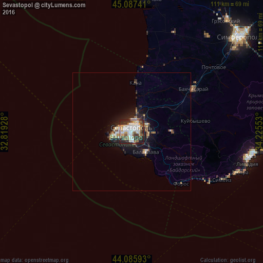
Analysis of Sevastopol night lights 2016
Square area 10x10 km:
 18.33%
90-99
17.12%80-89
6.82%70-79
6.52%60-69
4.55%50-59
8.18%40-49
8.79%30-39
8.64%20-29
18.64%10-19
2.42%0-9
0%Square area 50x50 km:
0.87%90-99
0.99%80-89
0.44%70-79
0.56%60-69
0.58%50-59
0.57%40-49
0.76%30-39
0.69%20-29
1.94%10-19
3.45%0-9
89.13%Clear (daylight) street map image can be seen on geolist.org.
Map coordinates:
45° 5' 14.7" North, 32° 49' 9.4" East
44° 36' 28.6" North, 33° 31' 16.8" East
44° 5' 9.3" North, 34° 13' 31.9" East
Some cities around Sevastopol sort by population:
• Bakhchysarai
31.2 km =19.4 mi,  58°
58°
• Balaklava
12.4 km =7.7 mi,  150°
150°
• Gaspra
50 km =31.1 mi,  112°
112°
• Inkerman
7 km =4.3 mi,  84°
84°
• Alupka
46.6 km =29 mi,  116°
116°
• Vilino
29 km =18 mi,  24°
24°
• Koreiz
48.7 km =30.3 mi, 113°
• Chisten’koye
51.5 km =32 mi,  53°
53°
694423 (p: 416,263)
Sources (retrieved 2019-11-25):
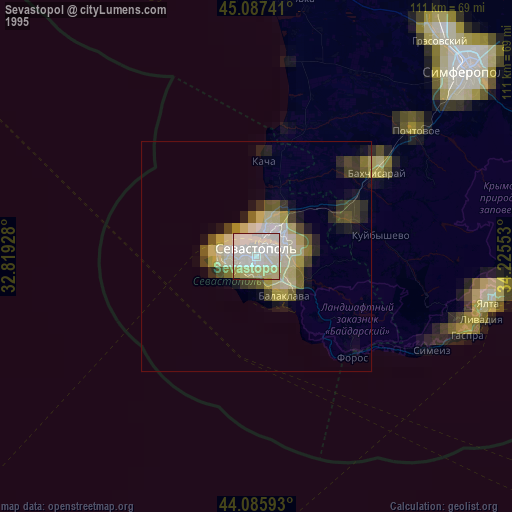
» NASA, Earths city lights 1995
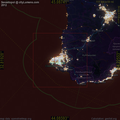
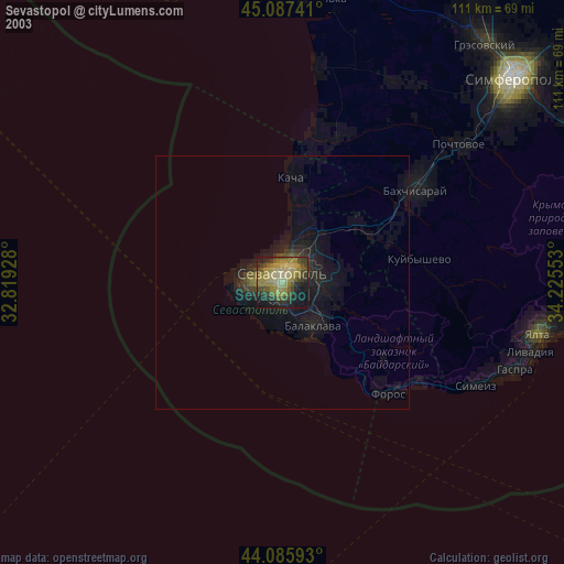
» NASA city lights 2003
» Earth at Night: Flat Maps 2012, 2016