Balaklava night lights from space
Night Light of Balaklava (Sevastopol City) from space (Ukraine) Src. Average luminocity for 10x10km area is 11.7413% and for 50x50km: 5.1147%.
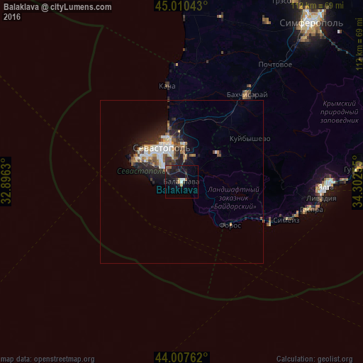
Analysis of Balaklava night lights 2016
Square area 10x10 km:
 0.48%
0.48%90-99
1.43%80-89
0.95%70-79
0.63%60-69
3.02%50-59
0.48%40-49
1.27%30-39
2.22%20-29
4.6%10-19
16.03%0-9
68.89%Square area 50x50 km:
0.86%90-99
0.98%80-89
0.44%70-79
0.57%60-69
0.56%50-59
0.58%40-49
0.72%30-39
0.61%20-29
1.9%10-19
3.46%0-9
89.3%Clear (daylight) street map image can be seen on geolist.org.
Map coordinates:
45° 0' 37.5" North, 32° 53' 46.7" East
44° 30' 40.2" North, 33° 35' 57.9" East
44° 0' 27.4" North, 34° 18' 9.2" East
Some cities around Balaklava sort by population:
• Sevastopol
12.4 km =7.7 mi,  330°
330°
• Yalta
45 km =28 mi,  91°
91°
• Bakhchysarai
34 km =21.1 mi,  36°
36°
• Gaspra
40.9 km =25.4 mi,  102°
102°
• Inkerman
11.5 km =7.1 mi,  4°
4°
• Alupka
36.9 km =22.9 mi,  106°
106°
• Vilino
37.6 km =23.4 mi,  8°
8°
• Koreiz
39.5 km =24.5 mi, 102°
712930 (p: 18,649)
Sources (retrieved 2019-11-25):
» Earth at Night: Flat Maps 2012, 2016