Kozyatyn night lights from space
Night Light of Kozyatyn (Vinnyts'ka) from space (Ukraine) Src. Average luminocity for 10x10km area is 3.9412% and for 50x50km: 1.0824%.
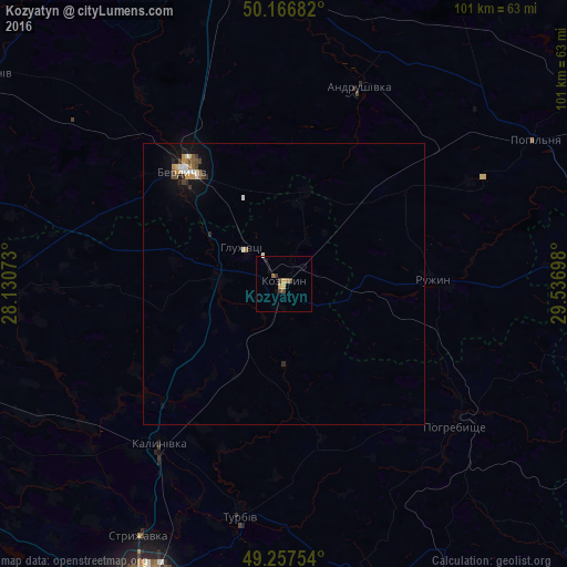
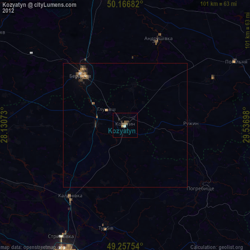
Analysis of Kozyatyn night lights 2016
Square area 10x10 km:
 0%
0%90-99
0.27%80-89
0%70-79
1.74%60-69
0.53%50-59
0.4%40-49
1.6%30-39
1.07%20-29
0%10-19
1.34%0-9
93.05%Square area 50x50 km:
0.11%90-99
0.17%80-89
0.08%70-79
0.21%60-69
0.09%50-59
0.19%40-49
0.17%30-39
0.19%20-29
0.12%10-19
0.71%0-9
97.96%Clear (daylight) street map image can be seen on geolist.org.
Map coordinates:
50° 10' 0.6" North, 28° 7' 50.6" East
49° 42' 51.5" North, 28° 50' 1.9" East
49° 15' 27.1" North, 29° 32' 13.1" East
Some cities around Kozyatyn sort by population:
• Vinnytsia
59.3 km =36.8 mi,  205°
205°
• Berdychiv
26.4 km =16.4 mi,  321°
321°
• Kalynivka
36.5 km =22.7 mi,  217°
217°
• Pohrebyshche
40 km =24.9 mi,  129°
129°
• Andrushivka
36.8 km =22.9 mi,  21°
21°
• Turbiv
41.5 km =25.8 mi,  191°
191°
• Popilnia
51.7 km =32.1 mi,  59°
59°
• Ozerne
52.1 km =32.4 mi,  352°
352°
706571 (p: 25,645)
Sources (retrieved 2019-11-25):
» Earth at Night: Flat Maps 2012, 2016