Kherson night lights from space
Night Light of Kherson from space (Ukraine) Src. Average luminocity for 10x10km area is 58.5367% and for 50x50km: 3.6664%.
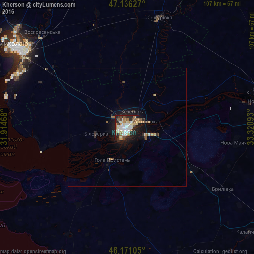
Analysis of Kherson night lights 2016
Square area 10x10 km:
 11.73%
90-99
16.86%80-89
10.7%70-79
3.67%60-69
9.68%50-59
4.11%40-49
5.43%30-39
1.91%20-29
20.09%10-19
14.81%0-9
1.03%Square area 50x50 km:
0.47%90-99
0.73%80-89
0.52%70-79
0.21%60-69
0.61%50-59
0.35%40-49
0.42%30-39
0.27%20-29
1.3%10-19
2.93%0-9
92.2%Clear (daylight) street map image can be seen on geolist.org.
Map coordinates:
47° 8' 10.6" North, 31° 54' 52.8" East
46° 39' 20.9" North, 32° 37' 4.1" East
46° 10' 15.8" North, 33° 19' 15.3" East
Some cities around Kherson sort by population:
• Tsyurupyns’k
8.8 km =5.5 mi,  118°
118°
• Hola Prystan’
16 km =9.9 mi,  206°
206°
• Bilozerka
13.8 km =8.6 mi,  255°
255°
• Chornobayivka
6.5 km =4 mi,  311°
311°
• Nova Mayachka
46.9 km =29.1 mi,  97°
97°
• Komyshany
8.7 km =5.4 mi, 256°
• Oleksandrivka
23 km =14.3 mi,  28°
28°
• Velyki Kopani
33.1 km =20.6 mi, 124°
706448 (p: 320,477)
Sources (retrieved 2019-11-25):
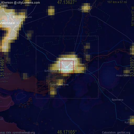
» NASA, Earths city lights 1995
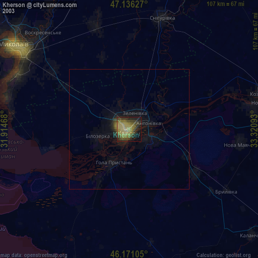
» NASA city lights 2003
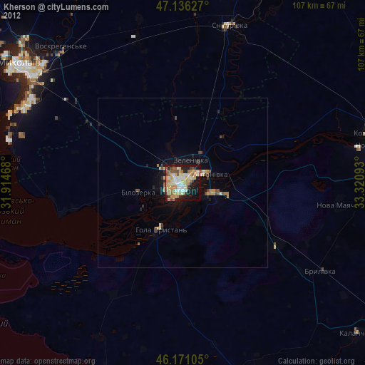
» Earth at Night: Flat Maps 2012, 2016