Ilovays’k night lights from space
Night Light of Ilovays’k (Donetsk) from space (Ukraine) Src. Average luminocity for 10x10km area is 1.2898% and for 50x50km: 4.6746%.
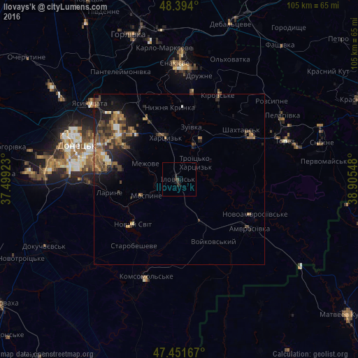
Analysis of Ilovays’k night lights 2016
Square area 10x10 km:
 0%
0%90-99
0%80-89
0%70-79
0%60-69
0%50-59
0%40-49
1.14%30-39
0.71%20-29
1.42%10-19
0.85%0-9
95.88%Square area 50x50 km:
0.19%90-99
0.46%80-89
0.33%70-79
0.77%60-69
0.8%50-59
1.29%40-49
1.35%30-39
0.82%20-29
1.54%10-19
3.01%0-9
89.45%Clear (daylight) street map image can be seen on geolist.org.
Map coordinates:
48° 23' 38.4" North, 37° 29' 57.2" East
47° 55' 29.9" North, 38° 12' 8.5" East
47° 27' 6" North, 38° 54' 19.7" East
Some cities around Ilovays’k sort by population:
• Makiyivka
24.7 km =15.3 mi,  303°
303°
• Shakhtars’k
22.9 km =14.2 mi,  50°
50°
• Khartsyz’k
13.7 km =8.5 mi,  342°
342°
• Zuhres
10.7 km =6.6 mi,  25°
25°
• Nyzhnya Krynka
21.2 km =13.2 mi,  351°
351°
• Mospyne
11 km =6.8 mi,  249°
249°
• Novyy Svit
18.9 km =11.7 mi,  225°
225°
• Starobesheve
23.3 km =14.5 mi,  213°
213°
707679 (p: 17,621)
Sources (retrieved 2019-11-25):
» Earth at Night: Flat Maps 2012, 2016