Desna night lights from space
Night Light of Desna (Chernihiv) from space (Ukraine) Src. Average luminocity for 10x10km area is 0.1345% and for 50x50km: 0.0052%.
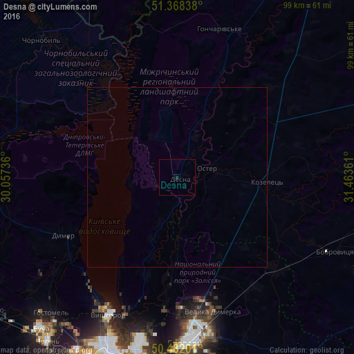
Analysis of Desna night lights 2016
Square area 10x10 km:
 0%
0%90-99
0%80-89
0%70-79
0%60-69
0%50-59
0%40-49
0%30-39
0%20-29
0.56%10-19
0%0-9
99.44%Square area 50x50 km:
0%90-99
0%80-89
0%70-79
0%60-69
0%50-59
0%40-49
0%30-39
0%20-29
0.02%10-19
0%0-9
99.98%Clear (daylight) street map image can be seen on geolist.org.
Map coordinates:
51° 22' 6.2" North, 30° 3' 26.5" East
50° 55' 38.3" North, 30° 45' 37.7" East
50° 28' 55.2" North, 31° 27' 49" East
Some cities around Desna sort by population:
• Brovary
45.6 km =28.3 mi,  175°
175°
• Vyshhorod
42.6 km =26.5 mi,  206°
206°
• Bobrovytsya
48.8 km =30.3 mi,  114°
114°
• Velyka Dymerka
38.5 km =23.9 mi,  164°
164°
• Kozelets’
25.3 km =15.7 mi,  93°
93°
• Novi Petrivtsi
40.1 km =24.9 mi, 213°
• Oster
8.9 km =5.5 mi,  73°
73°
• Dymer
35.8 km =22.2 mi,  244°
244°
710071 (p: 6,906)
Sources (retrieved 2019-11-25):
» Earth at Night: Flat Maps 2012, 2016