Chervonohrad night lights from space
Night Light of Chervonohrad (Lviv) from space (Ukraine) Src. Average luminocity for 10x10km area is 8.0084% and for 50x50km: 0.6035%.
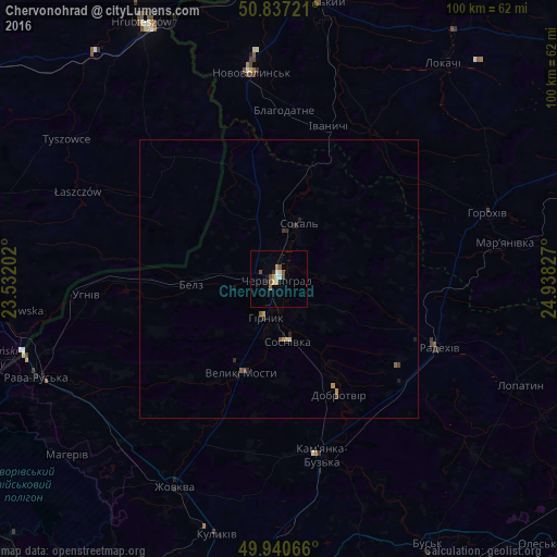
Analysis of Chervonohrad night lights 2016
Square area 10x10 km:
 1.26%
1.26%90-99
0.98%80-89
0.84%70-79
0.84%60-69
0.56%50-59
1.4%40-49
2.52%30-39
0%20-29
0.56%10-19
0.98%0-9
90.06%Square area 50x50 km:
0.05%90-99
0.05%80-89
0.09%70-79
0.1%60-69
0.02%50-59
0.13%40-49
0.16%30-39
0.05%20-29
0.15%10-19
0.19%0-9
99.01%Clear (daylight) street map image can be seen on geolist.org.
Map coordinates:
50° 50' 14" North, 23° 31' 55.3" East
50° 23' 27.8" North, 24° 14' 6.5" East
49° 56' 26.4" North, 24° 56' 17.8" East
Some cities around Chervonohrad sort by population:
• Novovolyns’k
37.6 km =23.4 mi,  352°
352°
• Volodymyr-Volynskyi
51.7 km =32.1 mi,  6°
6°
• Sokal’
9.9 km =6.2 mi,  20°
20°
• Hrubieszów, PL
52 km =32.3 mi,  332°
332°
• Zhovkva
41.4 km =25.7 mi,  206°
206°
• Rava-Rus’ka
46.6 km =29 mi,  247°
247°
• Dublyany
55.2 km =34.3 mi,  191°
191°
• Staryy Dobrotvir
20.4 km =12.7 mi,  150°
150°
710554 (p: 83,000)
Sources (retrieved 2019-11-25):
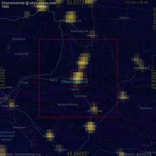
» NASA, Earths city lights 1995
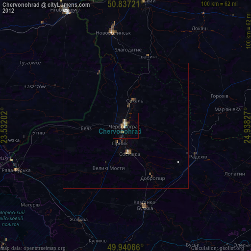
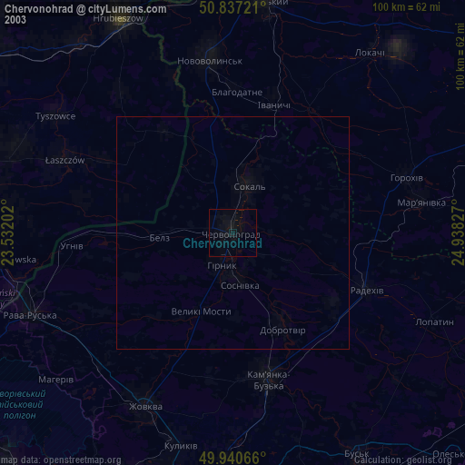
» NASA city lights 2003
» Earth at Night: Flat Maps 2012, 2016