Boryspil’ night lights from space
Night Light of Boryspil’ (Kyiv) from space (Ukraine) Src. Average luminocity for 10x10km area is 33.2647% and for 50x50km: 13.1213%.
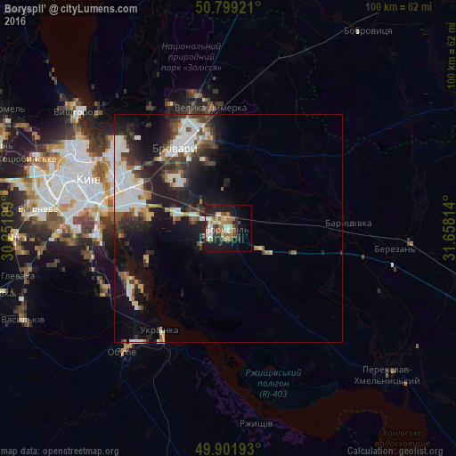
Analysis of Boryspil’ night lights 2016
Square area 10x10 km:
 4.2%
4.2%90-99
5.46%80-89
4.76%70-79
2.24%60-69
8.82%50-59
4.76%40-49
3.36%30-39
3.5%20-29
10.92%10-19
23.67%0-9
28.29%Square area 50x50 km:
3.1%90-99
2.5%80-89
1.02%70-79
0.86%60-69
1.31%50-59
1.23%40-49
1.8%30-39
2.42%20-29
3.85%10-19
9.1%0-9
72.81%Clear (daylight) street map image can be seen on geolist.org.
Map coordinates:
50° 47' 57.2" North, 30° 15' 6.8" East
50° 21' 9.7" North, 30° 57' 18" East
49° 54' 6.9" North, 31° 39' 29.3" East
Some cities around Boryspil’ sort by population:
• Kyiv
32.6 km =20.3 mi,  290°
290°
• Brovary
21.2 km =13.2 mi,  330°
330°
• Ukrainka
27.6 km =17.1 mi,  212°
212°
• Baryshivka
26 km =16.2 mi,  87°
87°
• Velyka Dymerka
27 km =16.8 mi,  352°
352°
• Trebukhiv
15.1 km =9.4 mi, 345°
• Hnidyn
17.5 km =10.9 mi,  261°
261°
• Knyazhichi
17.2 km =10.7 mi,  315°
315°
711660 (p: 55,000)
Sources (retrieved 2019-11-25):
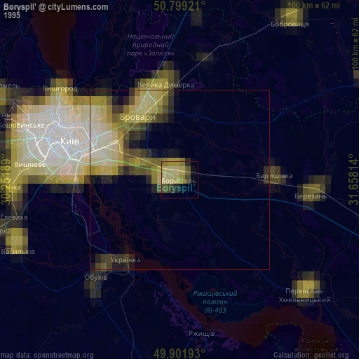
» NASA, Earths city lights 1995
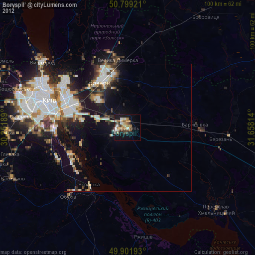
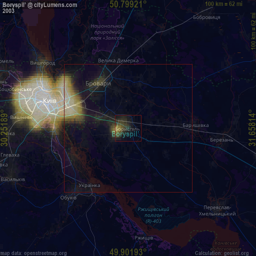
» NASA city lights 2003
» Earth at Night: Flat Maps 2012, 2016