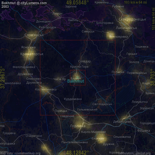
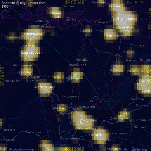
Bakhmut night lights from space
Night Light of Bakhmut (Donetsk) from space (Ukraine) Src. Average luminocity for 10x10km area is 5.7902% and for 50x50km: 1.2042%.

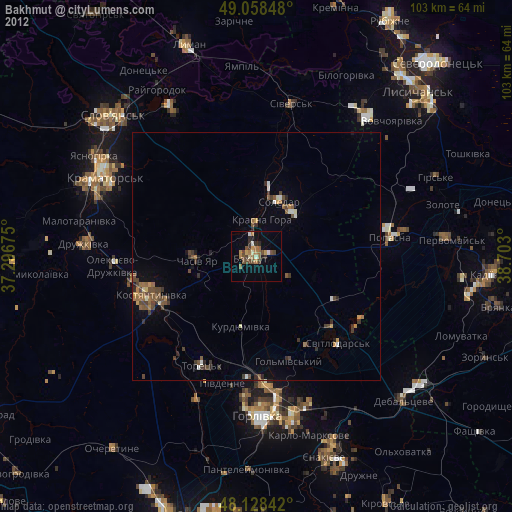
Analysis of Bakhmut night lights 2016
Square area 10x10 km:
 0%
0%90-99
0%80-89
0%70-79
0%60-69
1.34%50-59
3.13%40-49
1.04%30-39
3.13%20-29
2.08%10-19
1.79%0-9
87.5%Square area 50x50 km:
0.01%90-99
0.06%80-89
0.1%70-79
0.08%60-69
0.14%50-59
0.3%40-49
0.56%30-39
0.5%20-29
0.26%10-19
0.26%0-9
97.73%Clear (daylight) street map image can be seen on geolist.org.
Map coordinates:
49° 3' 30.5" North, 37° 17' 48.3" East
48° 35' 44.1" North, 37° 59' 59.5" East
48° 7' 42.3" North, 38° 42' 10.8" East
Some cities around Bakhmut sort by population:
• Horlivka
29.2 km =18.1 mi,  172°
172°
• Kostyantynivka
22.8 km =14.2 mi,  250°
250°
• Toretsk
24.6 km =15.3 mi,  207°
207°
• Popasna
28.1 km =17.5 mi,  81°
81°
• Chasiv Yar
10.5 km =6.5 mi,  268°
268°
• Sivers’k
31.1 km =19.3 mi,  13°
13°
• Soledar
11.4 km =7.1 mi,  35°
35°
• Svetlodarsk
24.4 km =15.2 mi,  137°
137°
713174 (p: 80,500)
Sources (retrieved 2019-11-25):
» NASA, Earths city lights 1995
» NASA city lights 2003
» Earth at Night: Flat Maps 2012, 2016