Kingori night lights from space
Night Light of Kingori (Arusha) from space (Tanzania) Src. Average luminocity for 10x10km area is 0% and for 50x50km: 0.5037%.
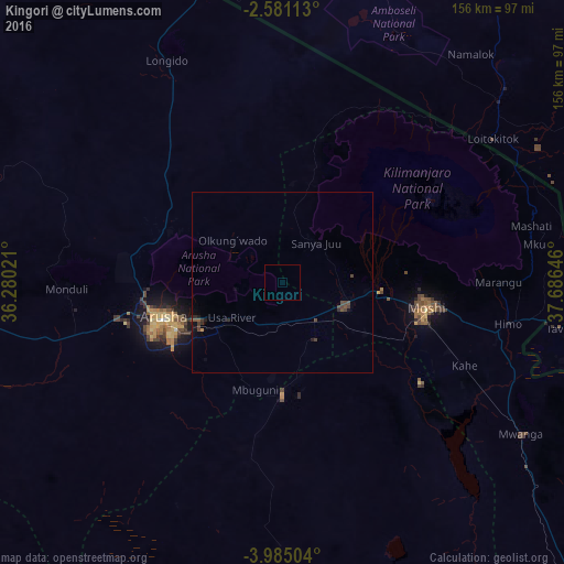
Analysis of Kingori night lights 2016
Square area 10x10 km:
 0%
0%90-99
0%80-89
0%70-79
0%60-69
0%50-59
0%40-49
0%30-39
0%20-29
0%10-19
0%0-9
100%Square area 50x50 km:
0%90-99
0%80-89
0%70-79
0.03%60-69
0.01%50-59
0.09%40-49
0.4%30-39
0.17%20-29
0.17%10-19
0.22%0-9
98.91%Clear (daylight) street map image can be seen on geolist.org.
Map coordinates:
2° 34' 52.1" South, 36° 16' 48.8" East
3° 16' 60" South, 36° 58' 60" East
3° 59' 6.1" South, 37° 41' 11.3" East
Some cities around Kingori sort by population:
• Arusha
34.6 km =21.5 mi,  254°
254°
• Moshi
39.6 km =24.6 mi,  100°
100°
• Merelani
31 km =19.3 mi,  180°
180°
• Usa River
17.5 km =10.9 mi,  237°
237°
• Mbuguni
31.7 km =19.7 mi,  186°
186°
• Nkoaranga
21.1 km =13.1 mi, 254°
• Poli
21.1 km =13.1 mi, 254°
• Monduli
59.2 km =36.8 mi,  268°
268°
157268 (p: 22,839)
Sources (retrieved 2019-11-25):
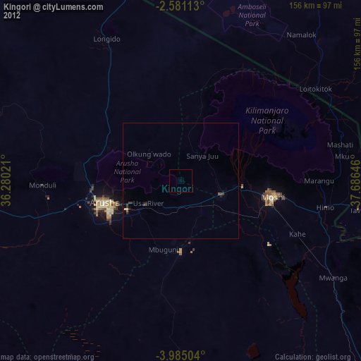
» Earth at Night: Flat Maps 2012, 2016