Şefaatlı night lights from space
Night Light of Şefaatlı (Yozgat) from space (Turkey) Src. Average luminocity for 10x10km area is 7.8214% and for 50x50km: 2.2009%.
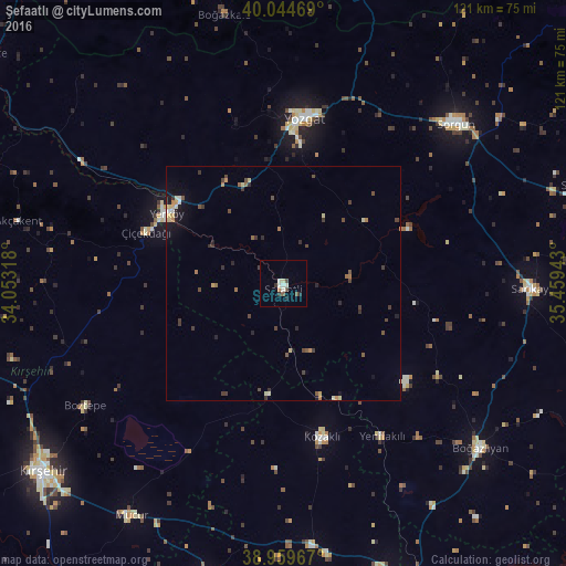
Analysis of Şefaatlı night lights 2016
Square area 10x10 km:
 0.81%
0.81%90-99
2.44%80-89
0.65%70-79
0.49%60-69
0.16%50-59
0.81%40-49
1.79%30-39
1.46%20-29
0.81%10-19
0.65%0-9
89.94%Square area 50x50 km:
0.06%90-99
0.31%80-89
0.35%70-79
0.21%60-69
0.3%50-59
0.3%40-49
0.55%30-39
0.6%20-29
0.44%10-19
0.76%0-9
96.13%Clear (daylight) street map image can be seen on geolist.org.
Map coordinates:
40° 2' 40.9" North, 34° 3' 11.4" East
39° 30' 15.5" North, 34° 45' 22.7" East
38° 57' 34.8" North, 35° 27' 33.9" East
Some cities around Şefaatlı sort by population:
• Kırşehir
64.7 km =40.2 mi,  231°
231°
• Yozgat
35.3 km =21.9 mi,  6°
6°
• Sorgun
50.1 km =31.1 mi,  47°
47°
• Yerköy
28.9 km =18 mi,  300°
300°
• Mucur
58.8 km =36.5 mi,  213°
213°
• Yenifakılı
38.7 km =24 mi,  147°
147°
• Saraykent
68 km =42.3 mi,  71°
71°
• Hacıbektaş
65 km =40.4 mi,  195°
195°
301353 (p: 13,922)
Sources (retrieved 2019-11-25):
» Earth at Night: Flat Maps 2012, 2016