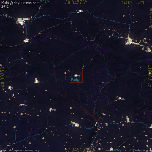
Kulp night lights from space
Night Light of Kulp (Diyarbakır) from space (Turkey) Src. Average luminocity for 10x10km area is 6.8929% and for 50x50km: 0.7688%.
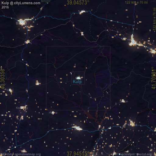
Analysis of Kulp night lights 2016
Square area 10x10 km:
100  0.65%
0.65%
90-99 2.76%
80-89 0.16%
70-79 1.3%
60-69 0%
50-59 0.49%
40-49 0.16%
30-39 1.79%
20-29 0.49%
10-19 0%
0-9 92.21%
0.65%90-99
2.76%80-89
0.16%70-79
1.3%60-69
0%50-59
0.49%40-49
0.16%30-39
1.79%20-29
0.49%10-19
0%0-9
92.21%Square area 50x50 km:
100 0.03%
90-99 0.13%
80-89 0.01%
70-79 0.09%
60-69 0.12%
50-59 0.23%
40-49 0.14%
30-39 0.16%
20-29 0.29%
10-19 0.17%
0-9 98.63%
0.03%90-99
0.13%80-89
0.01%70-79
0.09%60-69
0.12%50-59
0.23%40-49
0.14%30-39
0.16%20-29
0.29%10-19
0.17%0-9
98.63%Clear (daylight) street map image can be seen on geolist.org.
Map coordinates:
39° 2' 44.6" North, 40° 18' 12.8" East
38° 29' 51.1" North, 41° 0' 24" East
37° 56' 42.5" North, 41° 42' 35.3" East
Some cities around Kulp sort by population:
• Muş
49 km =30.4 mi,  57°
57°
• Silvan
40.1 km =24.9 mi,  179°
179°
• Genç
48.2 km =30 mi,  305°
305°
• Lice
32.3 km =20.1 mi,  262°
262°
• Solhan
52.2 km =32.4 mi,  4°
4°
• Sason
40.2 km =25 mi,  118°
118°
• Kocaköy
50 km =31.1 mi,  242°
242°
• Hazro
34.4 km =21.4 mi,  216°
216°
305750 (p: 26,569)
Sources (retrieved 2019-11-25):
» Earth at Night: Flat Maps 2012, 2016