İhsaniye night lights from space
Night Light of İhsaniye (Afyonkarahisar) from space (Turkey) Src. Average luminocity for 10x10km area is 7.3701% and for 50x50km: 4.5813%.
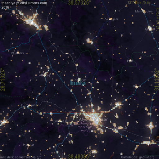
Analysis of İhsaniye night lights 2016
Square area 10x10 km:
 0%
0%90-99
1.3%80-89
1.46%70-79
1.46%60-69
0.65%50-59
0.65%40-49
1.3%30-39
1.46%20-29
1.3%10-19
0.49%0-9
89.94%Square area 50x50 km:
0.09%90-99
0.61%80-89
0.53%70-79
0.47%60-69
0.68%50-59
0.79%40-49
0.58%30-39
1.03%20-29
1.67%10-19
2.63%0-9
90.93%Clear (daylight) street map image can be seen on geolist.org.
Map coordinates:
39° 34' 23.7" North, 29° 42' 47.8" East
39° 1' 45" North, 30° 24' 59" East
38° 28' 51.1" North, 31° 7' 10.3" East
Some cities around İhsaniye sort by population:
• Kütahya
57.6 km =35.8 mi,  319°
319°
• Afyonkarahisar
32.2 km =20 mi,  160°
160°
• Sandıklı
64 km =39.8 mi,  191°
191°
• Emirdağ
63.4 km =39.4 mi,  90°
90°
• Şuhut
56.5 km =35.1 mi,  168°
168°
• İscehisar
34.3 km =21.3 mi,  122°
122°
• Işıklar
48.7 km =30.3 mi,  144°
144°
• Sinanpaşa
35 km =21.7 mi,  205°
205°
311645 (p: 5,767)
Sources (retrieved 2019-11-25):
» Earth at Night: Flat Maps 2012, 2016