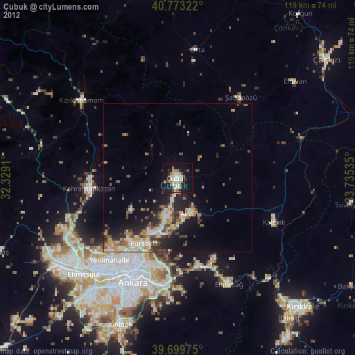
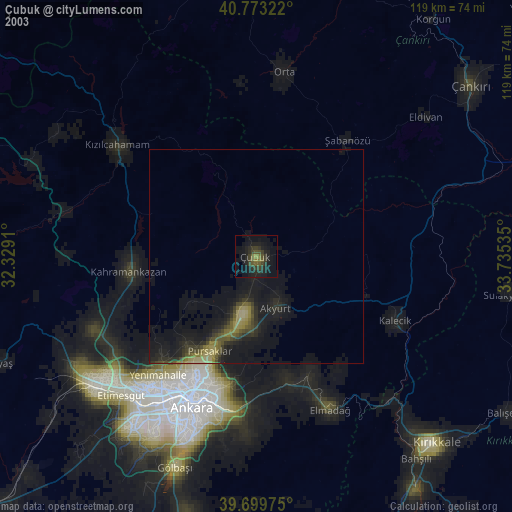
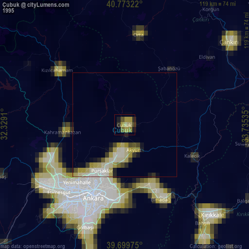
Çubuk night lights from space
Night Light of Çubuk (Ankara) from space (Turkey) Src. Average luminocity for 10x10km area is 36.4123% and for 50x50km: 13.0193%.
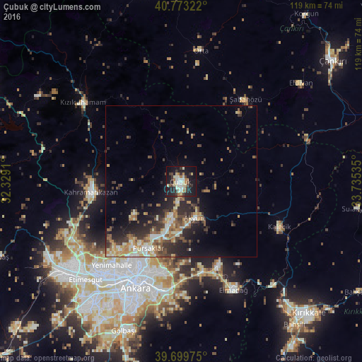
Analysis of Çubuk night lights 2016
Square area 10x10 km:
 3.73%
3.73%90-99
8.6%80-89
7.47%70-79
1.46%60-69
4.71%50-59
2.11%40-49
4.06%30-39
6.66%20-29
10.55%10-19
39.77%0-9
10.88%Square area 50x50 km:
1%90-99
2.45%80-89
1.81%70-79
1.34%60-69
2.04%50-59
1.94%40-49
2.11%30-39
2.89%20-29
4.55%10-19
6.99%0-9
72.88%Clear (daylight) street map image can be seen on geolist.org.
Map coordinates:
40° 46' 23.6" North, 32° 19' 44.8" East
40° 14' 19" North, 33° 1' 56" East
39° 41' 59.1" North, 33° 44' 7.3" East
Some cities around Çubuk sort by population:
• Ankara
38.5 km =23.9 mi,  203°
203°
• Çankaya
38.5 km =23.9 mi, 202°
• Batikent
39.5 km =24.5 mi,  220°
220°
• Elmadağ
39.2 km =24.4 mi,  154°
154°
• Kazan
29.6 km =18.4 mi,  268°
268°
• Kalecik
35.6 km =22.1 mi,  116°
116°
• Akyurt
12.4 km =7.7 mi,  158°
158°
• Şabanözü
34.5 km =21.4 mi,  38°
38°
748870 (p: 62,602)
Sources (retrieved 2019-11-25):
» NASA, Earths city lights 1995
» NASA city lights 2003
» Earth at Night: Flat Maps 2012, 2016