Batikent night lights from space
Night Light of Batikent (Ankara) from space (Turkey) Src. Average luminocity for 10x10km area is 95.5765% and for 50x50km: 50.7759%.
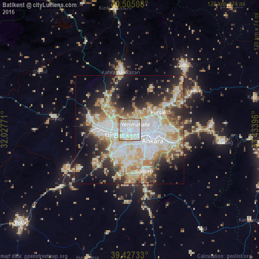
Analysis of Batikent night lights 2016
Square area 10x10 km:
 43.54%
90-99
37.76%80-89
14.97%70-79
1.87%60-69
1.87%50-59
0%40-49
0%30-39
0%20-29
0%10-19
0%0-9
0%Square area 50x50 km:
13.25%90-99
12.35%80-89
7.82%70-79
5.98%60-69
6.33%50-59
4.38%40-49
4.58%30-39
5.29%20-29
7.62%10-19
12.28%0-9
20.13%Clear (daylight) street map image can be seen on geolist.org.
Map coordinates:
40° 30' 18.3" North, 32° 1' 39.8" East
39° 58' 6" North, 32° 43' 51" East
39° 25' 38.4" North, 33° 26' 2.3" East
Some cities around Batikent sort by population:
• Ankara
11.8 km =7.3 mi,  117°
117°
• Çankaya
12.6 km =7.8 mi, 116°
• Çubuk
39.5 km =24.5 mi,  40°
40°
• Elmadağ
42.9 km =26.7 mi,  97°
97°
• Kazan
29.6 km =18.4 mi,  352°
352°
• Akyurt
35.5 km =22.1 mi,  58°
58°
• Ayaş
34.4 km =21.4 mi,  279°
279°
• Güdül
49.3 km =30.6 mi,  303°
303°
442301 (p: 300,000)
Sources (retrieved 2019-11-25):
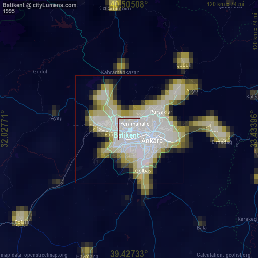
» NASA, Earths city lights 1995
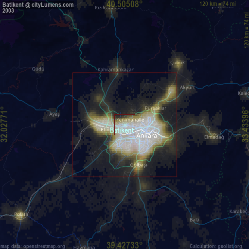
» NASA city lights 2003
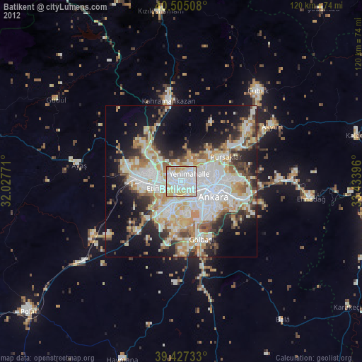
» Earth at Night: Flat Maps 2012, 2016