Başmakçı night lights from space
Night Light of Başmakçı (Afyonkarahisar) from space (Turkey) Src. Average luminocity for 10x10km area is 6.5438% and for 50x50km: 5.9683%.
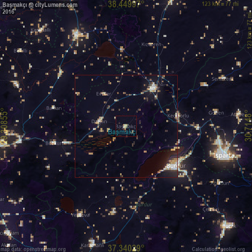
Analysis of Başmakçı night lights 2016
Square area 10x10 km:
 0%
0%90-99
0.65%80-89
1.14%70-79
1.46%60-69
0.65%50-59
1.14%40-49
0.81%30-39
1.62%20-29
1.62%10-19
0.97%0-9
89.94%Square area 50x50 km:
0.33%90-99
0.8%80-89
0.64%70-79
0.96%60-69
0.87%50-59
0.58%40-49
0.91%30-39
1.31%20-29
1.51%10-19
3.25%0-9
88.83%Clear (daylight) street map image can be seen on geolist.org.
Map coordinates:
38° 26' 59.9" North, 29° 18' 30.8" East
37° 53' 50" North, 30° 0' 42" East
37° 20' 25" North, 30° 42' 53.3" East
Some cities around Başmakçı sort by population:
• Burdur
31.4 km =19.5 mi,  128°
128°
• Dinar
23 km =14.3 mi,  35°
35°
• Gönen
44.3 km =27.5 mi,  81°
81°
• Uluborlu
43.4 km =27 mi,  62°
62°
• Keçiborlu
26 km =16.2 mi, 78°
• Yeşilova
48.8 km =30.3 mi,  207°
207°
• Baklan
36.4 km =22.6 mi,  284°
284°
• Dazkırı
13.5 km =8.4 mi, 280°
321887 (p: 8,415)
Sources (retrieved 2019-11-25):
» Earth at Night: Flat Maps 2012, 2016