Alanya night lights from space
Night Light of Alanya (Antalya) from space (Turkey) Src. Average luminocity for 10x10km area is 51.4744% and for 50x50km: 11.7592%.
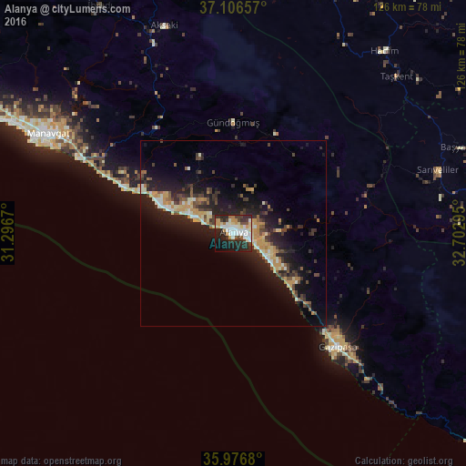

Analysis of Alanya night lights 2016
Square area 10x10 km:
 10.81%
90-99
14.47%80-89
5.68%70-79
7.69%60-69
3.11%50-59
0.92%40-49
6.04%30-39
7.88%20-29
22.89%10-19
15.93%0-9
4.58%Square area 50x50 km:
0.84%90-99
1.94%80-89
1.34%70-79
2.36%60-69
0.97%50-59
1.04%40-49
1.86%30-39
2.33%20-29
4.7%10-19
10.19%0-9
72.44%Clear (daylight) street map image can be seen on geolist.org.
Map coordinates:
37° 6' 23.7" North, 31° 17' 48.1" East
36° 32' 37.5" North, 31° 59' 59.4" East
35° 58' 36.5" North, 32° 42' 10.6" East
Some cities around Alanya sort by population:
• Manavgat
56.5 km =35.1 mi,  298°
298°
• Mahmutlar
9.8 km =6.1 mi,  123°
123°
• Gazipaşa
41.7 km =25.9 mi,  136°
136°
• Avsallar
22.4 km =13.9 mi,  293°
293°
• Sarıveliler
57.2 km =35.5 mi,  72°
72°
• Türkler
17.3 km =10.7 mi, 292°
• Eksere
30 km =18.6 mi,  359°
359°
• Payallar
14.8 km =9.2 mi, 295°
324190 (p: 112,969)
Sources (retrieved 2019-11-25):
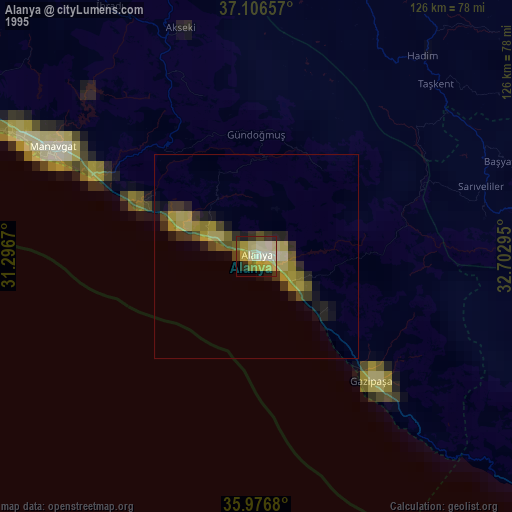
» NASA, Earths city lights 1995
» NASA city lights 2003
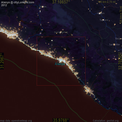
» Earth at Night: Flat Maps 2012, 2016