Adana night lights from space
Night Light of Adana from space (Turkey) Src. Average luminocity for 10x10km area is 95.7094% and for 50x50km: 22.4025%.
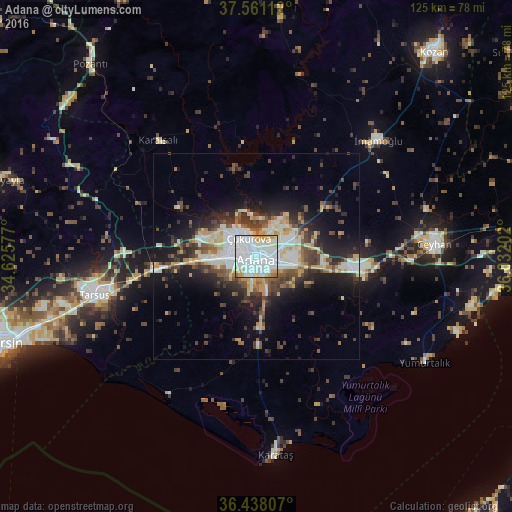
Analysis of Adana night lights 2016
Square area 10x10 km:
 57.47%
90-99
25.65%80-89
7.14%70-79
7.79%60-69
1.3%50-59
0.65%40-49
0%30-39
0%20-29
0%10-19
0%0-9
0%Square area 50x50 km:
4.31%90-99
4.86%80-89
2.84%70-79
2.7%60-69
1.4%50-59
2.48%40-49
3.66%30-39
3.69%20-29
5.49%10-19
10.94%0-9
57.63%Clear (daylight) street map image can be seen on geolist.org.
Map coordinates:
37° 33' 40" North, 34° 37' 32.8" East
37° 0' 6" North, 35° 19' 44" East
36° 26' 17.1" North, 36° 1' 55.3" East
Some cities around Adana sort by population:
• Mersin
64.9 km =40.3 mi,  251°
251°
• Tarsus
39.9 km =24.8 mi,  256°
256°
• Ceyhan
43.5 km =27 mi,  86°
86°
• İmamoğlu
41.3 km =25.7 mi,  44°
44°
• Pozantı
62.3 km =38.7 mi,  319°
319°
• Karataş
46.8 km =29.1 mi,  175°
175°
• Aladağ
61.1 km =38 mi,  5°
5°
• Karaisalı
37.1 km =23.1 mi, 319°
325363 (p: 1,248,988)
Sources (retrieved 2019-11-25):
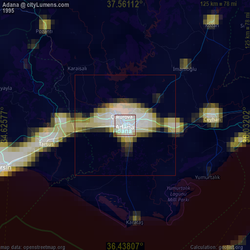
» NASA, Earths city lights 1995
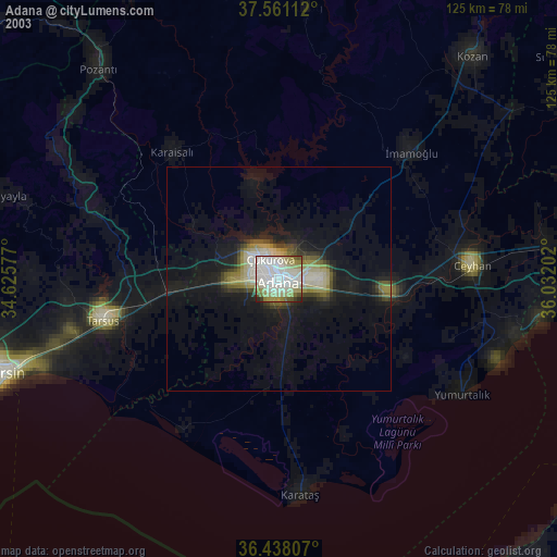
» NASA city lights 2003
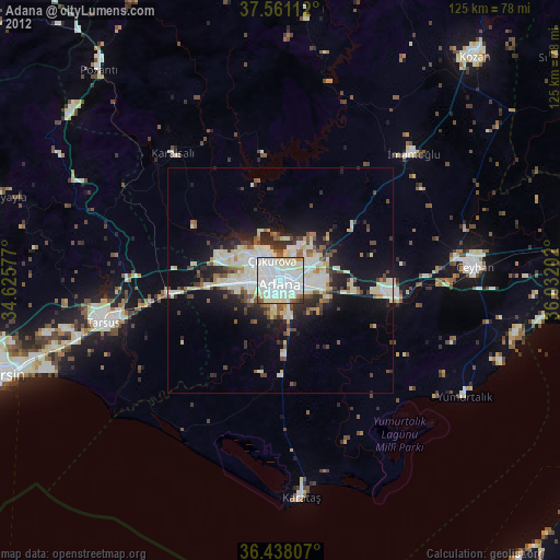
» Earth at Night: Flat Maps 2012, 2016