Béja night lights from space
Night Light of Béja (Bājah) from space (Tunisia) Src. Average luminocity for 10x10km area is 22.8828% and for 50x50km: 1.8999%.
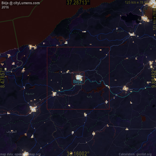

Analysis of Béja night lights 2016
Square area 10x10 km:
 4.03%
4.03%90-99
5.13%80-89
4.4%70-79
2.56%60-69
0.73%50-59
0.18%40-49
1.65%30-39
3.3%20-29
0.73%10-19
20.33%0-9
56.96%Square area 50x50 km:
0.18%90-99
0.3%80-89
0.42%70-79
0.23%60-69
0.33%50-59
0.08%40-49
0.12%30-39
0.15%20-29
0.22%10-19
0.86%0-9
97.11%Clear (daylight) street map image can be seen on geolist.org.
Map coordinates:
37° 17' 13.7" North, 8° 28' 42.9" East
36° 43' 32.3" North, 9° 10' 54.1" East
36° 9' 36.1" North, 9° 53' 5.4" East
Some cities around Béja sort by population:
• Jendouba
43.7 km =27.2 mi,  235°
235°
• Medjez el Bab
39.3 km =24.4 mi,  102°
102°
• Tabarka
45.5 km =28.3 mi,  304°
304°
• Testour
30.3 km =18.8 mi,  129°
129°
• Tabursuq
30.5 km =19 mi,  168°
168°
• Gafour
46.8 km =29.1 mi,  164°
164°
• Le Krib
44.4 km =27.6 mi,  185°
185°
• Sejenane
37.2 km =23.1 mi,  7°
7°
2472774 (p: 57,233)
Sources (retrieved 2019-11-25):
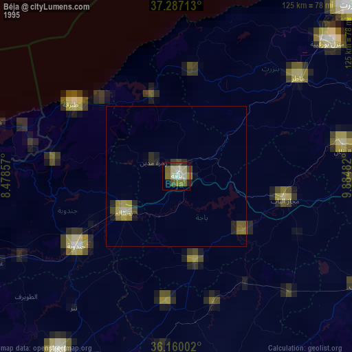
» NASA, Earths city lights 1995
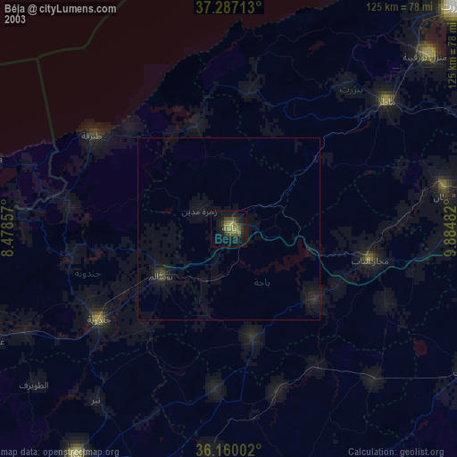
» NASA city lights 2003
» Earth at Night: Flat Maps 2012, 2016