Tak Bai night lights from space
Night Light of Tak Bai (Narathiwat) from space (Thailand) Src. Average luminocity for 10x10km area is 16.329% and for 50x50km: 13.7561%.
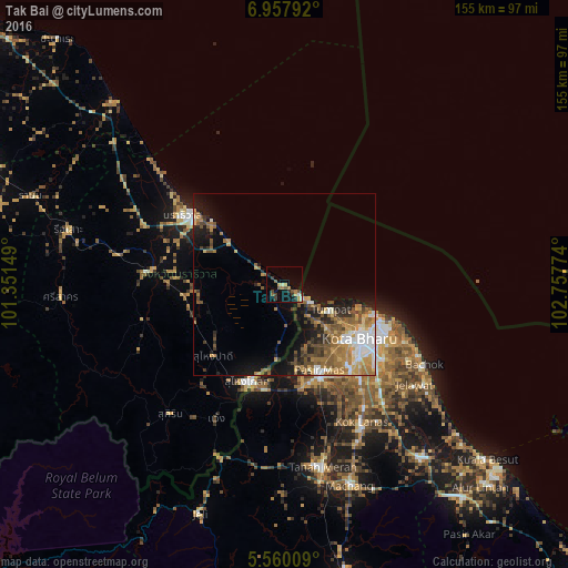
Analysis of Tak Bai night lights 2016
Square area 10x10 km:
 0.87%
0.87%90-99
1.3%80-89
0.87%70-79
2.6%60-69
3.25%50-59
4.11%40-49
2.81%30-39
3.9%20-29
1.73%10-19
9.96%0-9
68.61%Square area 50x50 km:
1.89%90-99
1.73%80-89
1.04%70-79
2.6%60-69
3.18%50-59
2.73%40-49
2.11%30-39
1.7%20-29
2.29%10-19
6.77%0-9
73.94%Clear (daylight) street map image can be seen on geolist.org.
Map coordinates:
6° 57' 28.5" North, 101° 21' 5.4" East
6° 15' 34.1" North, 102° 3' 16.6" East
5° 33' 36.3" North, 102° 45' 27.9" East
Some cities around Tak Bai sort by population:
• Kota Bharu, MY
25.8 km =16 mi,  125°
125°
• Narathiwat
31.6 km =19.6 mi,  305°
305°
• Su-ngai Kolok
27.4 km =17 mi,  201°
201°
• Peringat, MY
35.7 km =22.2 mi, 134°
• Kampong Kadok, MY
36 km =22.4 mi,  143°
143°
• Pasir Mas, MY
25.2 km =15.7 mi,  158°
158°
• Ban Su-ngai Pa Di
29 km =18 mi,  224°
224°
• Tumpat, MY
14.6 km =9.1 mi,  118°
118°
1605957 (p: 17,241)
Sources (retrieved 2019-11-25):
» Earth at Night: Flat Maps 2012, 2016