Sawang Wirawong night lights from space
Night Light of Sawang Wirawong (Ubon Ratchathani) from space (Thailand) Src. Average luminocity for 10x10km area is 3.7107% and for 50x50km: 8.2588%.
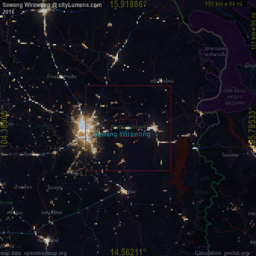
Analysis of Sawang Wirawong night lights 2016
Square area 10x10 km:
 0%
0%90-99
0%80-89
0.62%70-79
1.03%60-69
0%50-59
0.41%40-49
1.03%30-39
1.03%20-29
0.83%10-19
1.65%0-9
93.39%Square area 50x50 km:
0.5%90-99
1.01%80-89
0.78%70-79
1.49%60-69
1.27%50-59
1.17%40-49
1.68%30-39
2.17%20-29
2.36%10-19
4.1%0-9
83.47%Clear (daylight) street map image can be seen on geolist.org.
Map coordinates:
15° 55' 7.9" North, 104° 23' 20.7" East
15° 14' 29.7" North, 105° 5' 31.9" East
14° 33' 43.6" North, 105° 47' 43.2" East
Some cities around Sawang Wirawong sort by population:
• Ubon Ratchathani
26.1 km =16.2 mi,  269°
269°
• Pakse, LA
77 km =47.8 mi,  100°
100°
• Si Sa Ket
83.1 km =51.6 mi,  260°
260°
• Warin Chamrap
25.2 km =15.7 mi, 257°
• Kantharalak
82 km =51 mi,  215°
215°
• Det Udom
37.3 km =23.2 mi,  182°
182°
• Amnat Charoen
84.7 km =52.6 mi,  324°
324°
• Phibun Mangsahan
14.7 km =9.1 mi,  88°
88°
1613294 (p: 7,773)
Sources (retrieved 2019-11-25):
» Earth at Night: Flat Maps 2012, 2016