Lat Yao night lights from space
Night Light of Lat Yao (Nakhon Sawan) from space (Thailand) Src. Average luminocity for 10x10km area is 7.9567% and for 50x50km: 2.8493%.
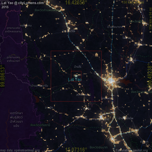
Analysis of Lat Yao night lights 2016
Square area 10x10 km:
 0.65%
0.65%90-99
0.22%80-89
1.73%70-79
0%60-69
0.87%50-59
1.95%40-49
0.87%30-39
4.11%20-29
3.46%10-19
0%0-9
86.15%Square area 50x50 km:
0.04%90-99
0.03%80-89
0.44%70-79
0.28%60-69
0.61%50-59
0.45%40-49
0.86%30-39
0.83%20-29
0.78%10-19
0.85%0-9
94.83%Clear (daylight) street map image can be seen on geolist.org.
Map coordinates:
16° 25' 35.7" North, 99° 5' 10.1" East
15° 45' 3.6" North, 99° 47' 21.3" East
15° 4' 23.4" North, 100° 29' 32.6" East
Some cities around Lat Yao sort by population:
• Nakhon Sawan
37.6 km =23.4 mi,  97°
97°
• Uthai Thani
48.4 km =30.1 mi,  148°
148°
• Khanu Woralaksaburi
35.4 km =22 mi,  12°
12°
• Thap Than
34.1 km =21.2 mi,  161°
161°
• Bang Mun Nak
70.2 km =43.6 mi,  63°
63°
• Lan Sak
40.2 km =25 mi,  214°
214°
• Phayuha Khiri
49.5 km =30.8 mi,  131°
131°
• Huai Khot
54.4 km =33.8 mi,  199°
199°
1152377 (p: 17,506)
Sources (retrieved 2019-11-25):
» Earth at Night: Flat Maps 2012, 2016