Ad Darbāsīyah night lights from space
Night Light of Ad Darbāsīyah (Al-Hasakah) from space (Syria) Src. Average luminocity for 10x10km area is 8.0204% and for 50x50km: 8.4145%.
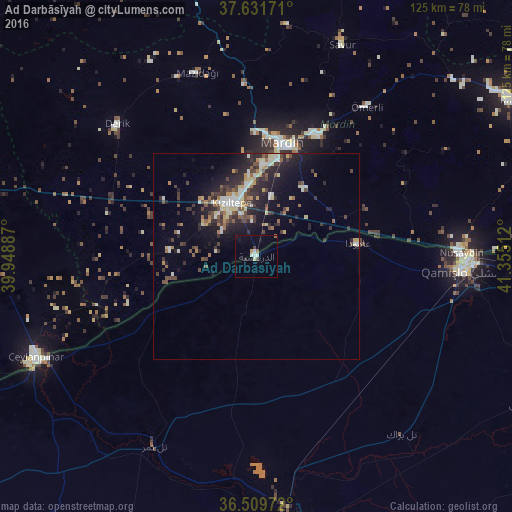
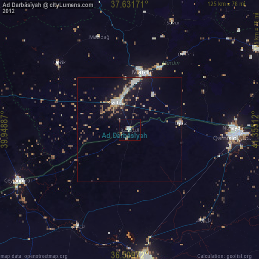
Analysis of Ad Darbāsīyah night lights 2016
Square area 10x10 km:
 1.02%
1.02%90-99
1.7%80-89
1.02%70-79
0.34%60-69
0%50-59
1.02%40-49
1.36%30-39
0%20-29
0.68%10-19
2.55%0-9
90.31%Square area 50x50 km:
0.81%90-99
1.35%80-89
1.02%70-79
0.57%60-69
0.94%50-59
1.07%40-49
1.68%30-39
1.68%20-29
3.31%10-19
5.66%0-9
81.91%Clear (daylight) street map image can be seen on geolist.org.
Map coordinates:
37° 37' 54.2" North, 39° 56' 55.9" East
37° 4' 22" North, 40° 39' 7.2" East
36° 30' 35" North, 41° 21' 18.4" East
Some cities around Ad Darbāsīyah sort by population:
• Kızıltepe, TR
14.5 km =9 mi,  332°
332°
• Mardin, TR
27.9 km =17.3 mi,  16°
16°
• Yeşilli, TR
32.9 km =20.4 mi,  26°
26°
• Mazıdağı, TR
47.5 km =29.5 mi,  341°
341°
• Kabala, TR
33.1 km =20.6 mi, 23°
• Ömerli, TR
45.1 km =28 mi,  36°
36°
• Akarsu, TR
39.3 km =24.4 mi,  64°
64°
• Ortaköy, TR
20.2 km =12.6 mi, 35°
170887 (p: 21,481)
Sources (retrieved 2019-11-25):
» Earth at Night: Flat Maps 2012, 2016