San Marino night lights from space
Night Light of San Marino from space (San Marino) Src. Average luminocity for 10x10km area is 40.8825% and for 50x50km: 21.0146%.
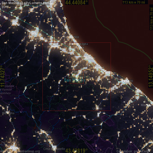
Analysis of San Marino night lights 2016
Square area 10x10 km:
 5.56%
5.56%90-99
8.25%80-89
5.87%70-79
2.54%60-69
5.71%50-59
3.17%40-49
6.67%30-39
6.98%20-29
22.22%10-19
27.94%0-9
5.08%Square area 50x50 km:
3.25%90-99
4.32%80-89
1.46%70-79
1.67%60-69
2.24%50-59
3.24%40-49
3.96%30-39
4.36%20-29
8.56%10-19
10.24%0-9
56.7%Clear (daylight) street map image can be seen on geolist.org.
Map coordinates:
44° 26' 27" North, 11° 44' 35.8" East
43° 56' 12" North, 12° 26' 47" East
43° 25' 41.5" North, 13° 8' 58.3" East
Some cities around San Marino sort by population:
• Serravalle
4.6 km =2.9 mi,  38°
38°
• Borgo Maggiore
0.6 km =0.4 mi,  7°
7°
• Domagnano
2.3 km =1.4 mi,  50°
50°
• Fiorentino
3.1 km =1.9 mi,  163°
163°
• Acquaviva
2.5 km =1.6 mi,  294°
294°
• Faetano
4.2 km =2.6 mi,  102°
102°
• Poggio di Chiesanuova
4.1 km =2.5 mi,  209°
209°
• Monte Giardino
4.2 km =2.6 mi,  137°
137°
3168070 (p: 4,500)
Sources (retrieved 2019-11-25):
» Earth at Night: Flat Maps 2012, 2016