Vrbové night lights from space
Night Light of Vrbové (Trnavský kraj) from space (Slovakia) Src. Average luminocity for 10x10km area is 3.4241% and for 50x50km: 3.3742%.
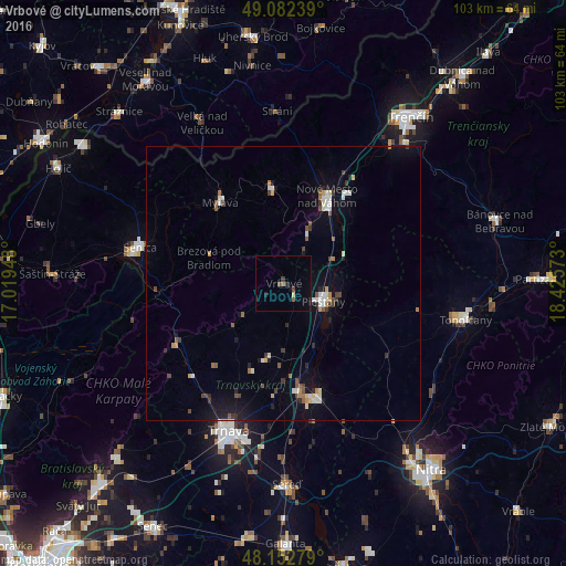
Analysis of Vrbové night lights 2016
Square area 10x10 km:
 0%
0%90-99
0%80-89
0.6%70-79
0%60-69
0%50-59
1.64%40-49
0.6%30-39
0.74%20-29
1.19%10-19
1.04%0-9
94.2%Square area 50x50 km:
0.45%90-99
0.44%80-89
0.33%70-79
0.24%60-69
0.31%50-59
0.47%40-49
0.46%30-39
0.46%20-29
0.47%10-19
2.08%0-9
94.3%Clear (daylight) street map image can be seen on geolist.org.
Map coordinates:
49° 4' 56.6" North, 17° 1' 10.1" East
48° 37' 11" North, 17° 43' 21.4" East
48° 9' 10" North, 18° 25' 32.6" East
Some cities around Vrbové sort by population:
• Trnava
28.7 km =17.8 mi,  200°
200°
• Piešťany
8.1 km =5 mi,  110°
110°
• Hlohovec
21.7 km =13.5 mi,  164°
164°
• Senica
26.9 km =16.7 mi,  284°
284°
• Nové Mesto nad Váhom
17.3 km =10.7 mi,  27°
27°
• Myjava
19.1 km =11.9 mi,  323°
323°
• Stará Turá
17.6 km =10.9 mi,  353°
353°
• Brezová pod Bradlom
14.3 km =8.9 mi,  289°
289°
3056697 (p: 6,249)
Sources (retrieved 2019-11-25):
» Earth at Night: Flat Maps 2012, 2016