Myjava night lights from space
Night Light of Myjava (Trenčiansky kraj) from space (Slovakia) Src. Average luminocity for 10x10km area is 3.544% and for 50x50km: 3.332%.
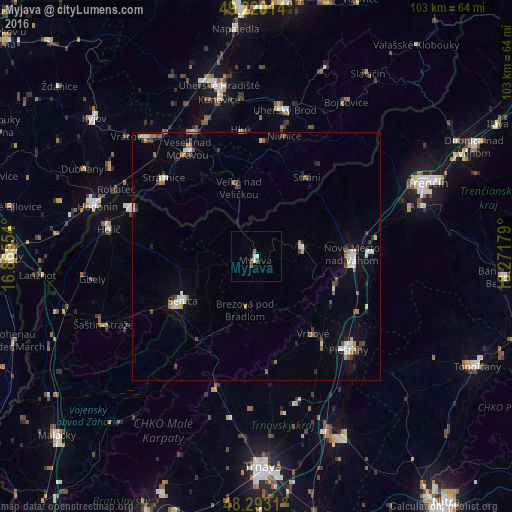
Analysis of Myjava night lights 2016
Square area 10x10 km:
 0.57%
0.57%90-99
1.14%80-89
0%70-79
0%60-69
0.57%50-59
1.14%40-49
0.57%30-39
0%20-29
0%10-19
0.57%0-9
95.45%Square area 50x50 km:
0.5%90-99
0.53%80-89
0.33%70-79
0.2%60-69
0.38%50-59
0.49%40-49
0.49%30-39
0.42%20-29
0.4%10-19
0.99%0-9
95.27%Clear (daylight) street map image can be seen on geolist.org.
Map coordinates:
49° 13' 12.5" North, 16° 51' 55.9" East
48° 45' 31.5" North, 17° 34' 7.2" East
48° 17' 35.2" North, 18° 16' 18.4" East
Some cities around Myjava sort by population:
• Piešťany
26.3 km =16.3 mi,  133°
133°
• Senica
17.2 km =10.7 mi,  239°
239°
• Nové Mesto nad Váhom
19.2 km =11.9 mi,  90°
90°
• Veselí nad Moravou, CZ
25.8 km =16 mi,  327°
327°
• Stará Turá
9.4 km =5.8 mi,  77°
77°
• Vrbové
19.1 km =11.9 mi,  143°
143°
• Strážnice, CZ
24.3 km =15.1 mi,  310°
310°
• Brezová pod Bradlom
10.8 km =6.7 mi,  191°
191°
3058611 (p: 13,142)
Sources (retrieved 2019-11-25):
» Earth at Night: Flat Maps 2012, 2016