Trnava night lights from space
Night Light of Trnava (Trnavský kraj) from space (Slovakia) Src. Average luminocity for 10x10km area is 37.5398% and for 50x50km: 8.4818%.
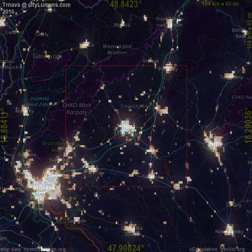
Analysis of Trnava night lights 2016
Square area 10x10 km:
 10.65%
90-99
10.09%80-89
1.42%70-79
0.57%60-69
3.55%50-59
2.7%40-49
2.7%30-39
2.56%20-29
12.78%10-19
38.64%0-9
14.35%Square area 50x50 km:
1.16%90-99
1.3%80-89
0.77%70-79
0.63%60-69
0.84%50-59
1.04%40-49
1.23%30-39
1.25%20-29
1.67%10-19
8%0-9
82.12%Clear (daylight) street map image can be seen on geolist.org.
Map coordinates:
48° 50' 32.3" North, 16° 53' 2.8" East
48° 22' 38.7" North, 17° 35' 14" East
47° 54' 29.7" North, 18° 17' 25.3" East
Some cities around Trnava sort by population:
• Piešťany
29.9 km =18.6 mi,  36°
36°
• Hlohovec
17 km =10.6 mi,  69°
69°
• Pezinok
25.6 km =15.9 mi,  247°
247°
• Galanta
23.3 km =14.5 mi,  153°
153°
• Senec
22.3 km =13.9 mi,  218°
218°
• Modra
21.3 km =13.2 mi,  256°
256°
• Vrbové
28.7 km =17.8 mi,  20°
20°
• Sládkovičovo
19.9 km =12.4 mi,  169°
169°
3057124 (p: 69,785)
Sources (retrieved 2019-11-25):
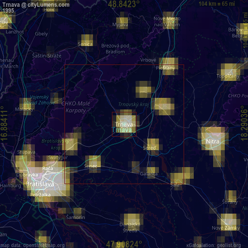
» NASA, Earths city lights 1995
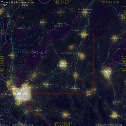
» NASA city lights 2003
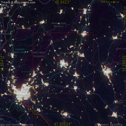
» Earth at Night: Flat Maps 2012, 2016