Stará Ľubovňa night lights from space
Night Light of Stará Ľubovňa (Prešovský kraj) from space (Slovakia) Src. Average luminocity for 10x10km area is 0.5735% and for 50x50km: 1.0488%.
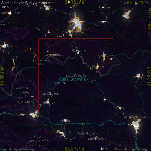
Analysis of Stará Ľubovňa night lights 2016
Square area 10x10 km:
 0%
0%90-99
0%80-89
0%70-79
0%60-69
0.53%50-59
0%40-49
0%30-39
0.53%20-29
0%10-19
0%0-9
98.93%Square area 50x50 km:
0.06%90-99
0.11%80-89
0.15%70-79
0.1%60-69
0.25%50-59
0.19%40-49
0.29%30-39
0.18%20-29
0.04%10-19
0.07%0-9
98.56%Clear (daylight) street map image can be seen on geolist.org.
Map coordinates:
49° 45' 17.9" North, 19° 58' 59.1" East
49° 17' 54.9" North, 20° 41' 10.3" East
48° 50' 16.6" North, 21° 23' 21.6" East
Some cities around Stará Ľubovňa sort by population:
• Kežmarok
25.8 km =16 mi,  225°
225°
• Krynica-Zdrój, PL
24.1 km =15 mi,  55°
55°
• Stary Sącz, PL
29.7 km =18.5 mi,  352°
352°
• Spišská Belá
20.6 km =12.8 mi, 233°
• Lipany
25.8 km =16 mi,  128°
128°
• Szczawnica, PL
20.2 km =12.6 mi,  313°
313°
• Piwniczna-Zdrój, PL
15.9 km =9.9 mi,  7°
7°
• Muszyna, PL
16.6 km =10.3 mi,  67°
67°
723505 (p: 16,000)
Sources (retrieved 2019-11-25):
» Earth at Night: Flat Maps 2012, 2016