Handlová night lights from space
Night Light of Handlová (Trenčiansky kraj) from space (Slovakia) Src. Average luminocity for 10x10km area is 1.6905% and for 50x50km: 1.4193%.
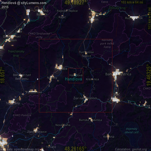
Analysis of Handlová night lights 2016
Square area 10x10 km:
 0.3%
0.3%90-99
0.3%80-89
0%70-79
0.15%60-69
0.45%50-59
0.15%40-49
1.04%30-39
0%20-29
0%10-19
0%0-9
97.62%Square area 50x50 km:
0.1%90-99
0.21%80-89
0.13%70-79
0.15%60-69
0.21%50-59
0.23%40-49
0.25%30-39
0.12%20-29
0.07%10-19
0.59%0-9
97.93%Clear (daylight) street map image can be seen on geolist.org.
Map coordinates:
49° 11' 21.4" North, 18° 3' 25.2" East
48° 43' 39.4" North, 18° 45' 36.4" East
48° 15' 41.9" North, 19° 27' 47.7" East
Some cities around Handlová sort by population:
• Banská Bystrica
28.9 km =18 mi,  87°
87°
• Prievidza
11 km =6.8 mi,  298°
298°
• Zvolen
33.5 km =20.8 mi,  120°
120°
• Partizánske
29.7 km =18.5 mi,  248°
248°
• Žiar nad Hronom
16.5 km =10.3 mi,  156°
156°
• Banská Štiavnica
32.9 km =20.4 mi, 160°
• Žarnovica
27.6 km =17.1 mi,  186°
186°
• Kremnica
11.9 km =7.4 mi,  102°
102°
3060139 (p: 18,018)
Sources (retrieved 2019-11-25):
» Earth at Night: Flat Maps 2012, 2016