Šentilj v Slov. Goricah night lights from space
Night Light of Šentilj v Slov. Goricah (Šentilj) from space (Slovenia) Src. Average luminocity for 10x10km area is 8.6222% and for 50x50km: 5.044%.
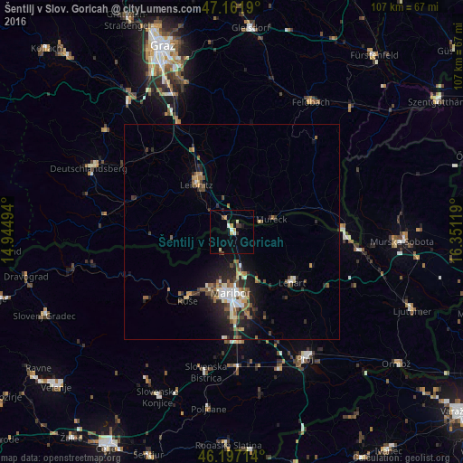
Analysis of Šentilj v Slov. Goricah night lights 2016
Square area 10x10 km:
 0.85%
0.85%90-99
1.42%80-89
0.99%70-79
1.85%60-69
0%50-59
0.14%40-49
0.99%30-39
2.41%20-29
0.28%10-19
0.57%0-9
90.48%Square area 50x50 km:
0.55%90-99
0.76%80-89
0.42%70-79
0.47%60-69
0.71%50-59
0.85%40-49
0.84%30-39
0.8%20-29
1.69%10-19
3.01%0-9
89.91%Clear (daylight) street map image can be seen on geolist.org.
Map coordinates:
47° 9' 42.8" North, 14° 56' 41.8" East
46° 40' 54" North, 15° 38' 53" East
46° 11' 49.7" North, 16° 21' 4.3" East
Some cities around Šentilj v Slov. Goricah sort by population:
• Maribor
14.1 km =8.8 mi,  180°
180°
• Leibnitz, AT
13.9 km =8.6 mi,  323°
323°
• Lenart v Slov. Goricah
18.3 km =11.4 mi,  129°
129°
• Selnica ob Dravi
18.7 km =11.6 mi,  218°
218°
• Pesnica pri Mariboru
8.6 km =5.3 mi,  165°
165°
• Zgornja Kungota
5.3 km =3.3 mi,  207°
207°
• Jurovski Dol
13.4 km =8.3 mi, 128°
• Sv. Ana v Slov. Goricah
15.4 km =9.6 mi,  103°
103°
3191039 (p: 1,826)
Sources (retrieved 2019-11-25):
» Earth at Night: Flat Maps 2012, 2016