Središče ob Dravi night lights from space
Night Light of Središče ob Dravi from space (Slovenia) Src. Average luminocity for 10x10km area is 4.5625% and for 50x50km: 5.2935%.
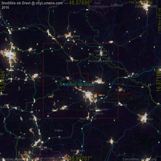
Analysis of Središče ob Dravi night lights 2016
Square area 10x10 km:
 0%
0%90-99
0%80-89
0.6%70-79
1.19%60-69
0.45%50-59
0.74%40-49
0.6%30-39
0%20-29
1.19%10-19
3.87%0-9
91.37%Square area 50x50 km:
0.69%90-99
0.75%80-89
0.37%70-79
0.45%60-69
0.58%50-59
1.02%40-49
0.81%30-39
0.86%20-29
1.01%10-19
4.18%0-9
89.29%Clear (daylight) street map image can be seen on geolist.org.
Map coordinates:
46° 52' 37.1" North, 15° 33' 53.8" East
46° 23' 39" North, 16° 16' 5" East
45° 54' 25.5" North, 16° 58' 16.3" East
Some cities around Središče ob Dravi sort by population:
• Varaždin, HR
11.3 km =7 mi,  151°
151°
• Čakovec, HR
12.8 km =8 mi,  94°
94°
• Ljutomer
15.1 km =9.4 mi,  339°
339°
• Ormož
8.9 km =5.5 mi,  282°
282°
• Črenšovci
18.4 km =11.4 mi,  8°
8°
• Sveti Tomaž
17.3 km =10.7 mi,  305°
305°
• Razkrižje
14.2 km =8.8 mi,  4°
4°
• Zavrč
16.7 km =10.4 mi,  269°
269°
3190150 (p: 1,124)
Sources (retrieved 2019-11-25):
» Earth at Night: Flat Maps 2012, 2016