Črenšovci night lights from space
Night Light of Črenšovci from space (Slovenia) Src. Average luminocity for 10x10km area is 1.5014% and for 50x50km: 3.5387%.
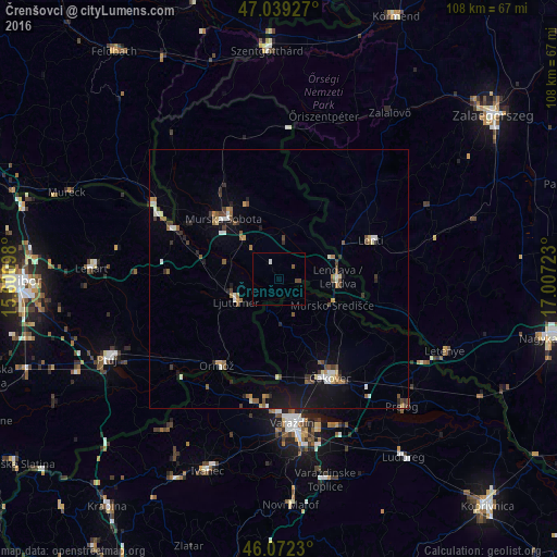
Analysis of Črenšovci night lights 2016
Square area 10x10 km:
100  0%
0%
90-99 0.57%
80-89 0%
70-79 0%
60-69 0%
50-59 0.57%
40-49 1.14%
30-39 0%
20-29 0%
10-19 0%
0-9 97.73%
0%90-99
0.57%80-89
0%70-79
0%60-69
0%50-59
0.57%40-49
1.14%30-39
0%20-29
0%10-19
0%0-9
97.73%Square area 50x50 km:
100 0.3%
90-99 0.53%
80-89 0.32%
70-79 0.29%
60-69 0.34%
50-59 0.74%
40-49 0.61%
30-39 0.59%
20-29 0.57%
10-19 2.19%
0-9 93.51%
0.3%90-99
0.53%80-89
0.32%70-79
0.29%60-69
0.34%50-59
0.74%40-49
0.61%30-39
0.59%20-29
0.57%10-19
2.19%0-9
93.51%Clear (daylight) street map image can be seen on geolist.org.
Map coordinates:
47° 2' 21.4" North, 15° 36' 3.5" East
46° 33' 28.6" North, 16° 18' 14.8" East
46° 4' 20.3" North, 17° 0' 26" East
Some cities around Črenšovci sort by population:
• Ljutomer
9.1 km =5.7 mi,  243°
243°
• Beltinci
7.2 km =4.5 mi,  317°
317°
• Odranci
3.7 km =2.3 mi,  330°
330°
• Turnišče
7.9 km =4.9 mi,  9°
9°
• Dobrovnik
11 km =6.8 mi,  19°
19°
• Velika Polana
3.6 km =2.2 mi,  64°
64°
• Veržej
11 km =6.8 mi,  285°
285°
• Razkrižje
4.4 km =2.7 mi,  203°
203°
3202524 (p: 1,178)
Sources (retrieved 2019-11-25):
» Earth at Night: Flat Maps 2012, 2016