Spodnji Duplek night lights from space
Night Light of Spodnji Duplek (Duplek) from space (Slovenia) Src. Average luminocity for 10x10km area is 13.5213% and for 50x50km: 6.7215%.
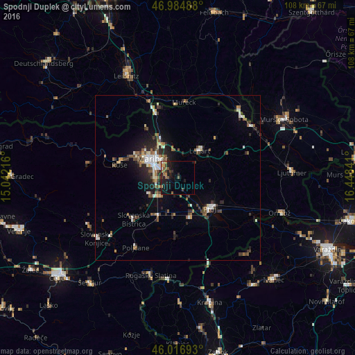
Analysis of Spodnji Duplek night lights 2016
Square area 10x10 km:
 0.85%
0.85%90-99
0.43%80-89
0.99%70-79
2.27%60-69
3.27%50-59
2.41%40-49
0.99%30-39
2.13%20-29
5.97%10-19
16.05%0-9
64.63%Square area 50x50 km:
0.79%90-99
1.18%80-89
0.47%70-79
0.49%60-69
0.81%50-59
1.13%40-49
1.17%30-39
1.13%20-29
2%10-19
3.32%0-9
87.52%Clear (daylight) street map image can be seen on geolist.org.
Map coordinates:
46° 59' 5.6" North, 15° 2' 31.8" East
46° 30' 11" North, 15° 44' 43" East
46° 1' 0.9" North, 16° 26' 54.3" East
Some cities around Spodnji Duplek sort by population:
• Maribor
9.5 km =5.9 mi,  307°
307°
• Miklavž na Dravskem Polju
3.7 km =2.3 mi,  274°
274°
• Lenart v Slov. Goricah
10.5 km =6.5 mi,  39°
39°
• Rače
7.5 km =4.7 mi,  220°
220°
• Kidričevo
11.6 km =7.2 mi,  162°
162°
• Starše
4.5 km =2.8 mi, 157°
• Trnovska Vas
11 km =6.8 mi,  80°
80°
• Destrnik
10.3 km =6.4 mi,  96°
96°
3190199 (p: 1,429)
Sources (retrieved 2019-11-25):
» Earth at Night: Flat Maps 2012, 2016