Odranci night lights from space
Night Light of Odranci from space (Slovenia) Src. Average luminocity for 10x10km area is 2.2884% and for 50x50km: 3.0081%.
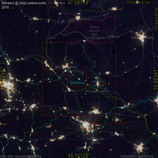
Analysis of Odranci night lights 2016
Square area 10x10 km:
100  0%
0%
90-99 0.57%
80-89 0.14%
70-79 0.14%
60-69 0.57%
50-59 0.57%
40-49 0.85%
30-39 0%
20-29 0.57%
10-19 0%
0-9 96.59%
0%90-99
0.57%80-89
0.14%70-79
0.14%60-69
0.57%50-59
0.57%40-49
0.85%30-39
0%20-29
0.57%10-19
0%0-9
96.59%Square area 50x50 km:
100 0.28%
90-99 0.52%
80-89 0.27%
70-79 0.22%
60-69 0.32%
50-59 0.6%
40-49 0.53%
30-39 0.54%
20-29 0.47%
10-19 0.85%
0-9 95.4%
0.28%90-99
0.52%80-89
0.27%70-79
0.22%60-69
0.32%50-59
0.6%40-49
0.53%30-39
0.54%20-29
0.47%10-19
0.85%0-9
95.4%Clear (daylight) street map image can be seen on geolist.org.
Map coordinates:
47° 4' 3.9" North, 15° 34' 37.8" East
46° 35' 12" North, 16° 16' 49" East
46° 6' 4.6" North, 16° 59' 0.3" East
Some cities around Odranci sort by population:
• Ljutomer
9.7 km =6 mi,  220°
220°
• Beltinci
3.7 km =2.3 mi,  304°
304°
• Turnišče
5.5 km =3.4 mi,  33°
33°
• Črenšovci
3.7 km =2.3 mi,  150°
150°
• Dobrovnik
9.1 km =5.7 mi,  37°
37°
• Velika Polana
5.4 km =3.4 mi,  107°
107°
• Veržej
8.8 km =5.5 mi,  267°
267°
• Razkrižje
7.2 km =4.5 mi,  179°
179°
3194213 (p: 1,693)
Sources (retrieved 2019-11-25):
» Earth at Night: Flat Maps 2012, 2016